You are here: Home > Network List > CN - Canadian National Seismograph Network Stations List
> Station INK INUVIK, NT > Earthquake Result Viewer
INK INUVIK, NT - Earthquake Result Viewer
*The percent match for this event was below the threshold and hence no stack was calculated.
| Earthquake location: |
Santa Cruz Islands Region |
| Earthquake latitude/longitude: |
-10.6/165.0 |
| Earthquake time(UTC): |
2016/07/04 (186) 09:25:41 GMT |
| Earthquake Depth: |
67 km |
| Earthquake Magnitude: |
5.6 MB |
| Earthquake Catalog/Contributor: |
NEIC PDE/NEIC COMCAT |
|
| Network: |
CN Canadian National Seismograph Network |
| Station: |
INK INUVIK, NT |
| Lat/Lon: |
68.31 N/133.53 W |
| Elevation: |
44 m |
|
| Distance: |
89.8 deg |
| Az: |
19.071 deg |
| Baz: |
239.76 deg |
| Ray Param: |
$rayparam |
*The percent match for this event was below the threshold and hence was not used in the summary stack. |
|
| Radial Match: |
65.70999 % |
| Radial Bump: |
400 |
| Transverse Match: |
63.24248 % |
| Transverse Bump: |
400 |
| SOD ConfigId: |
11737051 |
| Insert Time: |
2019-04-25 00:28:45.842 +0000 |
| GWidth: |
2.5 |
| Max Bumps: |
400 |
| Tol: |
0.001 |
|
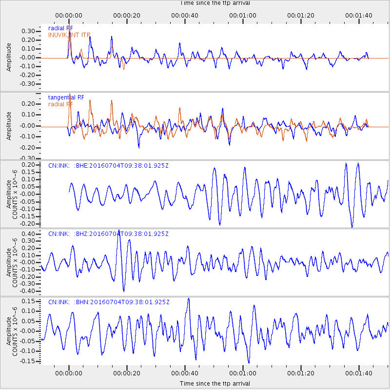
Signal To Noise
| Channel | StoN | STA | LTA |
| CN:INK: :BHZ:20160704T09:38:01.925Z | 2.3914418 | 1.29266E-7 | 5.4053583E-8 |
| CN:INK: :BHN:20160704T09:38:01.925Z | 1.5119425 | 6.539256E-8 | 4.3250697E-8 |
| CN:INK: :BHE:20160704T09:38:01.925Z | 1.3389148 | 5.98937E-8 | 4.473302E-8 |
| Arrivals |
| Ps | |
| PpPs | |
| PsPs/PpSs | |


