You are here: Home > Network List > TA - USArray Transportable Network (new EarthScope stations) Stations List
> Station F21K Alatna River, AK, USA > Earthquake Result Viewer
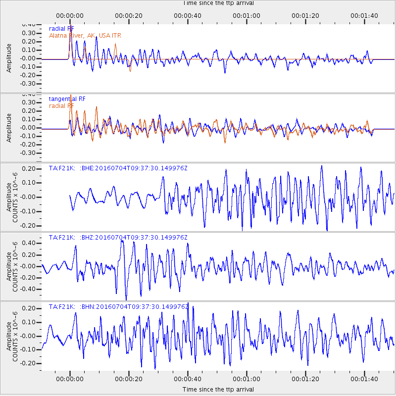
F21K Alatna River, AK, USA - Earthquake Result Viewer
*The percent match for this event was below the threshold and hence no stack was calculated.
| Earthquake location: |
Santa Cruz Islands Region |
| Earthquake latitude/longitude: |
-10.6/165.0 |
| Earthquake time(UTC): |
2016/07/04 (186) 09:25:41 GMT |
| Earthquake Depth: |
67 km |
| Earthquake Magnitude: |
5.6 MB |
| Earthquake Catalog/Contributor: |
NEIC PDE/NEIC COMCAT |
|
| Network: |
TA USArray Transportable Network (new EarthScope stations) |
| Station: |
F21K Alatna River, AK, USA |
| Lat/Lon: |
67.22 N/153.48 W |
| Elevation: |
597 m |
|
| Distance: |
83.2 deg |
| Az: |
15.072 deg |
| Baz: |
221.032 deg |
| Ray Param: |
$rayparam |
*The percent match for this event was below the threshold and hence was not used in the summary stack. |
|
| Radial Match: |
76.680405 % |
| Radial Bump: |
400 |
| Transverse Match: |
63.491245 % |
| Transverse Bump: |
400 |
| SOD ConfigId: |
11737051 |
| Insert Time: |
2019-04-25 00:30:29.433 +0000 |
| GWidth: |
2.5 |
| Max Bumps: |
400 |
| Tol: |
0.001 |
|
Signal To Noise
| Channel | StoN | STA | LTA |
| TA:F21K: :BHZ:20160704T09:37:30.149976Z | 2.9228337 | 1.6191959E-7 | 5.5398154E-8 |
| TA:F21K: :BHN:20160704T09:37:30.149976Z | 1.4176337 | 7.9002874E-8 | 5.5728698E-8 |
| TA:F21K: :BHE:20160704T09:37:30.149976Z | 1.9968754 | 7.228028E-8 | 3.619669E-8 |
| Arrivals |
| Ps | |
| PpPs | |
| PsPs/PpSs | |


