You are here: Home > Network List > TA - USArray Transportable Network (new EarthScope stations) Stations List
> Station P17K Kvichak River, AK, USA > Earthquake Result Viewer
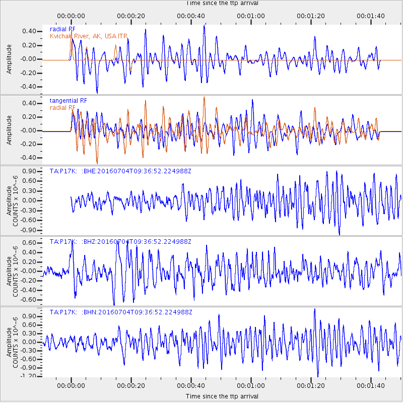
P17K Kvichak River, AK, USA - Earthquake Result Viewer
*The percent match for this event was below the threshold and hence no stack was calculated.
| Earthquake location: |
Santa Cruz Islands Region |
| Earthquake latitude/longitude: |
-10.6/165.0 |
| Earthquake time(UTC): |
2016/07/04 (186) 09:25:41 GMT |
| Earthquake Depth: |
67 km |
| Earthquake Magnitude: |
5.6 MB |
| Earthquake Catalog/Contributor: |
NEIC PDE/NEIC COMCAT |
|
| Network: |
TA USArray Transportable Network (new EarthScope stations) |
| Station: |
P17K Kvichak River, AK, USA |
| Lat/Lon: |
59.20 N/156.44 W |
| Elevation: |
91 m |
|
| Distance: |
76.2 deg |
| Az: |
19.299 deg |
| Baz: |
219.146 deg |
| Ray Param: |
$rayparam |
*The percent match for this event was below the threshold and hence was not used in the summary stack. |
|
| Radial Match: |
68.73577 % |
| Radial Bump: |
400 |
| Transverse Match: |
71.229225 % |
| Transverse Bump: |
400 |
| SOD ConfigId: |
11737051 |
| Insert Time: |
2019-04-25 00:30:59.434 +0000 |
| GWidth: |
2.5 |
| Max Bumps: |
400 |
| Tol: |
0.001 |
|
Signal To Noise
| Channel | StoN | STA | LTA |
| TA:P17K: :BHZ:20160704T09:36:52.224988Z | 3.4674156 | 3.0623283E-7 | 8.831732E-8 |
| TA:P17K: :BHN:20160704T09:36:52.224988Z | 0.9482203 | 1.6134307E-7 | 1.7015358E-7 |
| TA:P17K: :BHE:20160704T09:36:52.224988Z | 0.6932814 | 1.06801785E-7 | 1.5405257E-7 |
| Arrivals |
| Ps | |
| PpPs | |
| PsPs/PpSs | |


