You are here: Home > Network List > CI - Caltech Regional Seismic Network Stations List
> Station SWS Sam W. Stewart, Westmorland, CA, USA > Earthquake Result Viewer
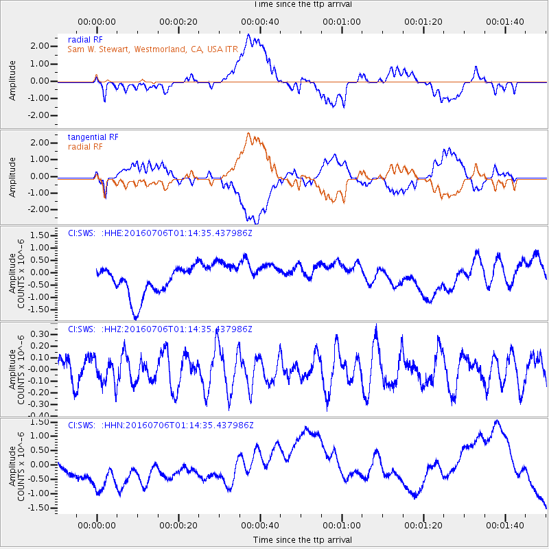
SWS Sam W. Stewart, Westmorland, CA, USA - Earthquake Result Viewer
*The percent match for this event was below the threshold and hence no stack was calculated.
| Earthquake location: |
Pacific-Antarctic Ridge |
| Earthquake latitude/longitude: |
-56.8/-142.1 |
| Earthquake time(UTC): |
2016/07/06 (188) 01:01:57 GMT |
| Earthquake Depth: |
10 km |
| Earthquake Magnitude: |
5.8 MWW, 5.7 MWB, 5.8 MWC, 5.9 MWC |
| Earthquake Catalog/Contributor: |
NEIC PDE/NEIC COMCAT |
|
| Network: |
CI Caltech Regional Seismic Network |
| Station: |
SWS Sam W. Stewart, Westmorland, CA, USA |
| Lat/Lon: |
32.94 N/115.80 W |
| Elevation: |
140 m |
|
| Distance: |
92.1 deg |
| Az: |
21.876 deg |
| Baz: |
194.12 deg |
| Ray Param: |
$rayparam |
*The percent match for this event was below the threshold and hence was not used in the summary stack. |
|
| Radial Match: |
25.76831 % |
| Radial Bump: |
400 |
| Transverse Match: |
23.796223 % |
| Transverse Bump: |
400 |
| SOD ConfigId: |
11737051 |
| Insert Time: |
2019-04-25 00:33:51.539 +0000 |
| GWidth: |
2.5 |
| Max Bumps: |
400 |
| Tol: |
0.001 |
|
Signal To Noise
| Channel | StoN | STA | LTA |
| CI:SWS: :HHZ:20160706T01:14:35.437986Z | 0.80903035 | 1.0458963E-7 | 1.2927777E-7 |
| CI:SWS: :HHN:20160706T01:14:35.437986Z | 1.6659818 | 1.1230834E-6 | 6.741271E-7 |
| CI:SWS: :HHE:20160706T01:14:35.437986Z | 1.3211856 | 7.460407E-7 | 5.646752E-7 |
| Arrivals |
| Ps | |
| PpPs | |
| PsPs/PpSs | |


