You are here: Home > Network List > IU - Global Seismograph Network (GSN - IRIS/USGS) Stations List
> Station RSSD Black Hills, South Dakota, USA > Earthquake Result Viewer
RSSD Black Hills, South Dakota, USA - Earthquake Result Viewer
*The percent match for this event was below the threshold and hence no stack was calculated.
| Earthquake location: |
Near Coast Of Ecuador |
| Earthquake latitude/longitude: |
-0.4/-80.8 |
| Earthquake time(UTC): |
2016/07/08 (190) 04:28:43 GMT |
| Earthquake Depth: |
7.1 km |
| Earthquake Magnitude: |
5.5 mwb |
| Earthquake Catalog/Contributor: |
NEIC PDE/ |
|
| Network: |
IU Global Seismograph Network (GSN - IRIS/USGS) |
| Station: |
RSSD Black Hills, South Dakota, USA |
| Lat/Lon: |
44.12 N/104.04 W |
| Elevation: |
2090 m |
|
| Distance: |
48.9 deg |
| Az: |
337.869 deg |
| Baz: |
148.461 deg |
| Ray Param: |
$rayparam |
*The percent match for this event was below the threshold and hence was not used in the summary stack. |
|
| Radial Match: |
71.184654 % |
| Radial Bump: |
400 |
| Transverse Match: |
66.915695 % |
| Transverse Bump: |
400 |
| SOD ConfigId: |
11737051 |
| Insert Time: |
2019-04-25 00:40:29.460 +0000 |
| GWidth: |
2.5 |
| Max Bumps: |
400 |
| Tol: |
0.001 |
|
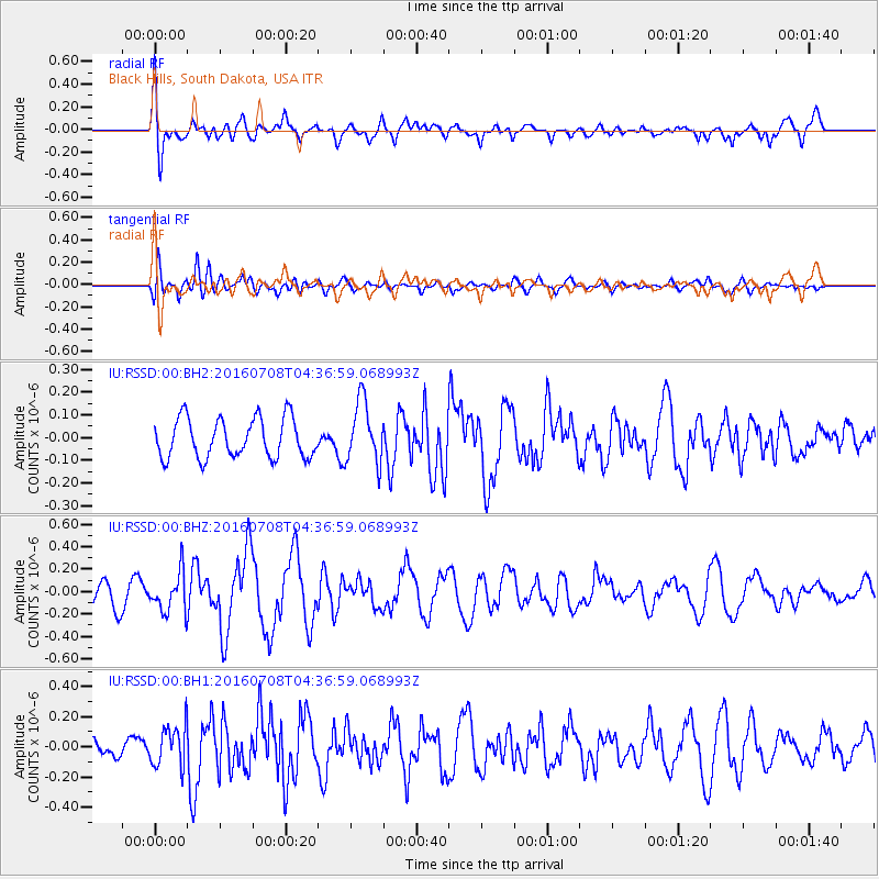
Signal To Noise
| Channel | StoN | STA | LTA |
| IU:RSSD:00:BHZ:20160708T04:36:59.068993Z | 1.6343384 | 1.7653092E-7 | 1.0801369E-7 |
| IU:RSSD:00:BH1:20160708T04:36:59.068993Z | 1.5928996 | 1.3586083E-7 | 8.5291525E-8 |
| IU:RSSD:00:BH2:20160708T04:36:59.068993Z | 1.5776148 | 1.3582931E-7 | 8.609789E-8 |
| Arrivals |
| Ps | |
| PpPs | |
| PsPs/PpSs | |


