You are here: Home > Network List > IW - Intermountain West Stations List
> Station MOOW Moose Ponds, Wyoming, USA > Earthquake Result Viewer
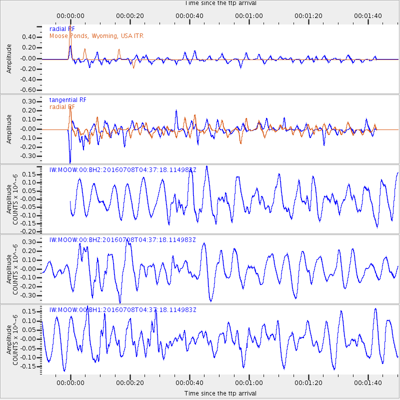
MOOW Moose Ponds, Wyoming, USA - Earthquake Result Viewer
*The percent match for this event was below the threshold and hence no stack was calculated.
| Earthquake location: |
Near Coast Of Ecuador |
| Earthquake latitude/longitude: |
-0.4/-80.8 |
| Earthquake time(UTC): |
2016/07/08 (190) 04:28:43 GMT |
| Earthquake Depth: |
7.1 km |
| Earthquake Magnitude: |
5.5 mwb |
| Earthquake Catalog/Contributor: |
NEIC PDE/ |
|
| Network: |
IW Intermountain West |
| Station: |
MOOW Moose Ponds, Wyoming, USA |
| Lat/Lon: |
43.75 N/110.74 W |
| Elevation: |
2128 m |
|
| Distance: |
51.5 deg |
| Az: |
332.457 deg |
| Baz: |
140.353 deg |
| Ray Param: |
$rayparam |
*The percent match for this event was below the threshold and hence was not used in the summary stack. |
|
| Radial Match: |
50.615257 % |
| Radial Bump: |
400 |
| Transverse Match: |
74.06405 % |
| Transverse Bump: |
400 |
| SOD ConfigId: |
11737051 |
| Insert Time: |
2019-04-25 00:40:34.529 +0000 |
| GWidth: |
2.5 |
| Max Bumps: |
400 |
| Tol: |
0.001 |
|
Signal To Noise
| Channel | StoN | STA | LTA |
| IW:MOOW:00:BHZ:20160708T04:37:18.114983Z | 2.3497498 | 1.7309912E-7 | 7.366704E-8 |
| IW:MOOW:00:BH1:20160708T04:37:18.114983Z | 1.1071386 | 6.834281E-8 | 6.1729224E-8 |
| IW:MOOW:00:BH2:20160708T04:37:18.114983Z | 1.0793579 | 7.962524E-8 | 7.3770934E-8 |
| Arrivals |
| Ps | |
| PpPs | |
| PsPs/PpSs | |


