You are here: Home > Network List > TA - USArray Transportable Network (new EarthScope stations) Stations List
> Station D25K Kavik River, AK, USA > Earthquake Result Viewer
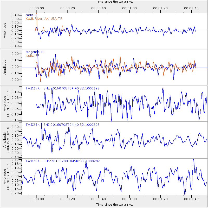
D25K Kavik River, AK, USA - Earthquake Result Viewer
*The percent match for this event was below the threshold and hence no stack was calculated.
| Earthquake location: |
Near Coast Of Ecuador |
| Earthquake latitude/longitude: |
-0.4/-80.8 |
| Earthquake time(UTC): |
2016/07/08 (190) 04:28:43 GMT |
| Earthquake Depth: |
7.1 km |
| Earthquake Magnitude: |
5.5 mwb |
| Earthquake Catalog/Contributor: |
NEIC PDE/ |
|
| Network: |
TA USArray Transportable Network (new EarthScope stations) |
| Station: |
D25K Kavik River, AK, USA |
| Lat/Lon: |
69.32 N/146.38 W |
| Elevation: |
770 m |
|
| Distance: |
81.9 deg |
| Az: |
340.936 deg |
| Baz: |
113.143 deg |
| Ray Param: |
$rayparam |
*The percent match for this event was below the threshold and hence was not used in the summary stack. |
|
| Radial Match: |
67.98378 % |
| Radial Bump: |
400 |
| Transverse Match: |
75.7145 % |
| Transverse Bump: |
400 |
| SOD ConfigId: |
11737051 |
| Insert Time: |
2019-04-25 00:43:47.184 +0000 |
| GWidth: |
2.5 |
| Max Bumps: |
400 |
| Tol: |
0.001 |
|
Signal To Noise
| Channel | StoN | STA | LTA |
| TA:D25K: :BHZ:20160708T04:40:32.100029Z | 2.8923144 | 1.5229796E-7 | 5.2656084E-8 |
| TA:D25K: :BHN:20160708T04:40:32.100029Z | 1.3473926 | 6.090992E-8 | 4.520577E-8 |
| TA:D25K: :BHE:20160708T04:40:32.100029Z | 1.0217291 | 4.6838867E-8 | 4.5842746E-8 |
| Arrivals |
| Ps | |
| PpPs | |
| PsPs/PpSs | |


