You are here: Home > Network List > TA - USArray Transportable Network (new EarthScope stations) Stations List
> Station J05D Fort Rock, OR, USA > Earthquake Result Viewer
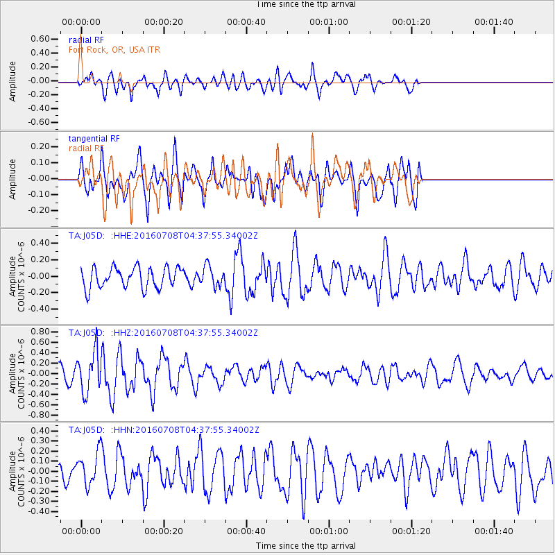
J05D Fort Rock, OR, USA - Earthquake Result Viewer
*The percent match for this event was below the threshold and hence no stack was calculated.
| Earthquake location: |
Near Coast Of Ecuador |
| Earthquake latitude/longitude: |
-0.4/-80.8 |
| Earthquake time(UTC): |
2016/07/08 (190) 04:28:43 GMT |
| Earthquake Depth: |
7.1 km |
| Earthquake Magnitude: |
5.5 mwb |
| Earthquake Catalog/Contributor: |
NEIC PDE/ |
|
| Network: |
TA USArray Transportable Network (new EarthScope stations) |
| Station: |
J05D Fort Rock, OR, USA |
| Lat/Lon: |
43.28 N/121.23 W |
| Elevation: |
1541 m |
|
| Distance: |
56.6 deg |
| Az: |
325.425 deg |
| Baz: |
129.004 deg |
| Ray Param: |
$rayparam |
*The percent match for this event was below the threshold and hence was not used in the summary stack. |
|
| Radial Match: |
47.050587 % |
| Radial Bump: |
400 |
| Transverse Match: |
43.62039 % |
| Transverse Bump: |
400 |
| SOD ConfigId: |
11737051 |
| Insert Time: |
2019-04-25 00:43:54.884 +0000 |
| GWidth: |
2.5 |
| Max Bumps: |
400 |
| Tol: |
0.001 |
|
Signal To Noise
| Channel | StoN | STA | LTA |
| TA:J05D: :HHZ:20160708T04:37:55.34002Z | 2.8168943 | 3.9442492E-7 | 1.400212E-7 |
| TA:J05D: :HHN:20160708T04:37:55.34002Z | 1.3297982 | 1.6990558E-7 | 1.2776793E-7 |
| TA:J05D: :HHE:20160708T04:37:55.34002Z | 0.9895385 | 1.2222571E-7 | 1.2351789E-7 |
| Arrivals |
| Ps | |
| PpPs | |
| PsPs/PpSs | |


