You are here: Home > Network List > US - United States National Seismic Network Stations List
> Station DUG Dugway, Tooele County, Utah, USA > Earthquake Result Viewer
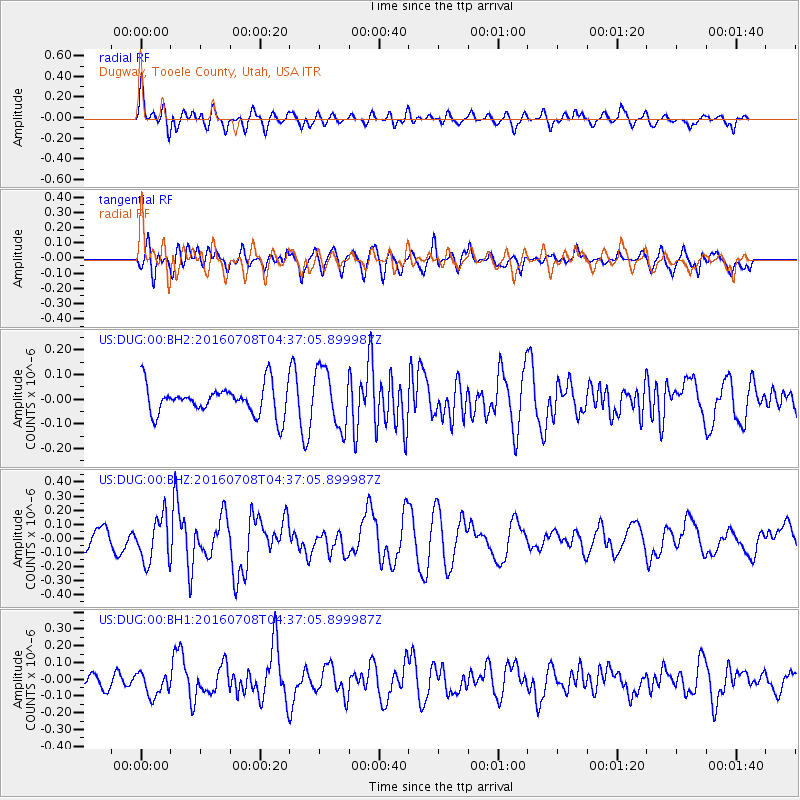
DUG Dugway, Tooele County, Utah, USA - Earthquake Result Viewer
*The percent match for this event was below the threshold and hence no stack was calculated.
| Earthquake location: |
Near Coast Of Ecuador |
| Earthquake latitude/longitude: |
-0.4/-80.8 |
| Earthquake time(UTC): |
2016/07/08 (190) 04:28:43 GMT |
| Earthquake Depth: |
7.1 km |
| Earthquake Magnitude: |
5.5 mwb |
| Earthquake Catalog/Contributor: |
NEIC PDE/ |
|
| Network: |
US United States National Seismic Network |
| Station: |
DUG Dugway, Tooele County, Utah, USA |
| Lat/Lon: |
40.19 N/112.81 W |
| Elevation: |
1477 m |
|
| Distance: |
49.8 deg |
| Az: |
327.91 deg |
| Baz: |
136.089 deg |
| Ray Param: |
$rayparam |
*The percent match for this event was below the threshold and hence was not used in the summary stack. |
|
| Radial Match: |
63.569122 % |
| Radial Bump: |
400 |
| Transverse Match: |
42.131737 % |
| Transverse Bump: |
400 |
| SOD ConfigId: |
11737051 |
| Insert Time: |
2019-04-25 00:44:32.405 +0000 |
| GWidth: |
2.5 |
| Max Bumps: |
400 |
| Tol: |
0.001 |
|
Signal To Noise
| Channel | StoN | STA | LTA |
| US:DUG:00:BHZ:20160708T04:37:05.899987Z | 2.4195595 | 1.58461E-7 | 6.5491676E-8 |
| US:DUG:00:BH1:20160708T04:37:05.899987Z | 1.0065196 | 6.985752E-8 | 6.9405026E-8 |
| US:DUG:00:BH2:20160708T04:37:05.899987Z | 1.96304 | 1.1696201E-7 | 5.958209E-8 |
| Arrivals |
| Ps | |
| PpPs | |
| PsPs/PpSs | |


