You are here: Home > Network List > US - United States National Seismic Network Stations List
> Station GLMI Grayling, Michigan, USA > Earthquake Result Viewer
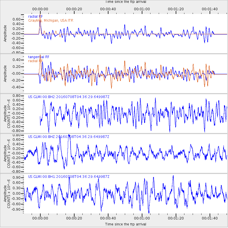
GLMI Grayling, Michigan, USA - Earthquake Result Viewer
*The percent match for this event was below the threshold and hence no stack was calculated.
| Earthquake location: |
Near Coast Of Ecuador |
| Earthquake latitude/longitude: |
-0.4/-80.8 |
| Earthquake time(UTC): |
2016/07/08 (190) 04:28:43 GMT |
| Earthquake Depth: |
7.1 km |
| Earthquake Magnitude: |
5.5 mwb |
| Earthquake Catalog/Contributor: |
NEIC PDE/ |
|
| Network: |
US United States National Seismic Network |
| Station: |
GLMI Grayling, Michigan, USA |
| Lat/Lon: |
44.82 N/84.62 W |
| Elevation: |
387 m |
|
| Distance: |
45.2 deg |
| Az: |
356.177 deg |
| Baz: |
174.624 deg |
| Ray Param: |
$rayparam |
*The percent match for this event was below the threshold and hence was not used in the summary stack. |
|
| Radial Match: |
65.98373 % |
| Radial Bump: |
400 |
| Transverse Match: |
56.902203 % |
| Transverse Bump: |
400 |
| SOD ConfigId: |
11737051 |
| Insert Time: |
2019-04-25 00:44:35.247 +0000 |
| GWidth: |
2.5 |
| Max Bumps: |
400 |
| Tol: |
0.001 |
|
Signal To Noise
| Channel | StoN | STA | LTA |
| US:GLMI:00:BHZ:20160708T04:36:29.649987Z | 2.1366184 | 3.361288E-7 | 1.5731813E-7 |
| US:GLMI:00:BH1:20160708T04:36:29.649987Z | 1.3794427 | 3.4941513E-7 | 2.5330166E-7 |
| US:GLMI:00:BH2:20160708T04:36:29.649987Z | 0.66475695 | 2.0004217E-7 | 3.0092525E-7 |
| Arrivals |
| Ps | |
| PpPs | |
| PsPs/PpSs | |


