You are here: Home > Network List > AZ - ANZA Regional Network Stations List
> Station SMER AZ.SMER > Earthquake Result Viewer
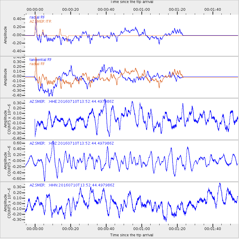
SMER AZ.SMER - Earthquake Result Viewer
*The percent match for this event was below the threshold and hence no stack was calculated.
| Earthquake location: |
Samoa Islands Region |
| Earthquake latitude/longitude: |
-15.0/-172.9 |
| Earthquake time(UTC): |
2016/07/10 (192) 13:41:53 GMT |
| Earthquake Depth: |
10 km |
| Earthquake Magnitude: |
5.5 MB |
| Earthquake Catalog/Contributor: |
NEIC PDE/NEIC ALERT |
|
| Network: |
AZ ANZA Regional Network |
| Station: |
SMER AZ.SMER |
| Lat/Lon: |
33.46 N/117.17 W |
| Elevation: |
355 m |
|
| Distance: |
71.7 deg |
| Az: |
46.665 deg |
| Baz: |
237.209 deg |
| Ray Param: |
$rayparam |
*The percent match for this event was below the threshold and hence was not used in the summary stack. |
|
| Radial Match: |
62.873848 % |
| Radial Bump: |
400 |
| Transverse Match: |
65.40712 % |
| Transverse Bump: |
400 |
| SOD ConfigId: |
11737051 |
| Insert Time: |
2019-04-25 00:55:18.813 +0000 |
| GWidth: |
2.5 |
| Max Bumps: |
400 |
| Tol: |
0.001 |
|
Signal To Noise
| Channel | StoN | STA | LTA |
| AZ:SMER: :HHZ:20160710T13:52:44.497986Z | 0.9688951 | 1.18685755E-7 | 1.2249598E-7 |
| AZ:SMER: :HHN:20160710T13:52:44.497986Z | 0.5978643 | 7.6107646E-8 | 1.272992E-7 |
| AZ:SMER: :HHE:20160710T13:52:44.497986Z | 1.7979134 | 1.5733394E-7 | 8.7509186E-8 |
| Arrivals |
| Ps | |
| PpPs | |
| PsPs/PpSs | |


