You are here: Home > Network List > TA - USArray Transportable Network (new EarthScope stations) Stations List
> Station G21K Allakaket, AK, USA > Earthquake Result Viewer
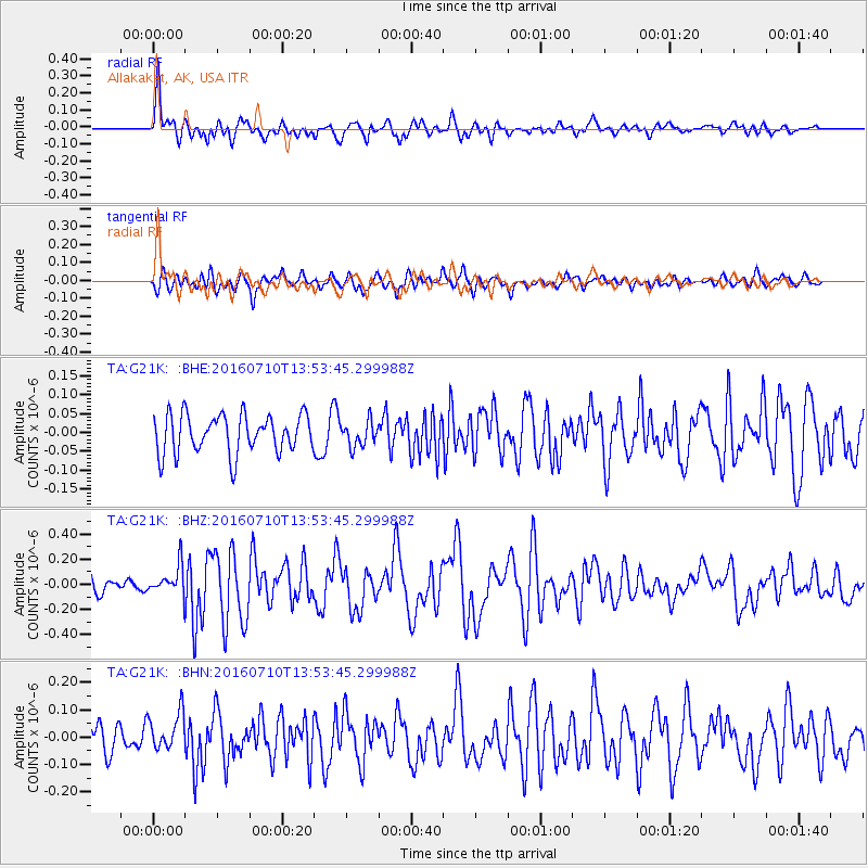
G21K Allakaket, AK, USA - Earthquake Result Viewer
*The percent match for this event was below the threshold and hence no stack was calculated.
| Earthquake location: |
Samoa Islands Region |
| Earthquake latitude/longitude: |
-15.0/-172.9 |
| Earthquake time(UTC): |
2016/07/10 (192) 13:41:53 GMT |
| Earthquake Depth: |
10 km |
| Earthquake Magnitude: |
5.5 MB |
| Earthquake Catalog/Contributor: |
NEIC PDE/NEIC ALERT |
|
| Network: |
TA USArray Transportable Network (new EarthScope stations) |
| Station: |
G21K Allakaket, AK, USA |
| Lat/Lon: |
66.52 N/153.51 W |
| Elevation: |
446 m |
|
| Distance: |
82.6 deg |
| Az: |
7.703 deg |
| Baz: |
198.853 deg |
| Ray Param: |
$rayparam |
*The percent match for this event was below the threshold and hence was not used in the summary stack. |
|
| Radial Match: |
75.735115 % |
| Radial Bump: |
385 |
| Transverse Match: |
71.80446 % |
| Transverse Bump: |
400 |
| SOD ConfigId: |
11737051 |
| Insert Time: |
2019-04-25 00:59:35.574 +0000 |
| GWidth: |
2.5 |
| Max Bumps: |
400 |
| Tol: |
0.001 |
|
Signal To Noise
| Channel | StoN | STA | LTA |
| TA:G21K: :BHZ:20160710T13:53:45.299988Z | 1.927886 | 1.1998608E-7 | 6.223713E-8 |
| TA:G21K: :BHN:20160710T13:53:45.299988Z | 1.4878268 | 6.8445395E-8 | 4.6003603E-8 |
| TA:G21K: :BHE:20160710T13:53:45.299988Z | 0.739386 | 3.7827053E-8 | 5.1160086E-8 |
| Arrivals |
| Ps | |
| PpPs | |
| PsPs/PpSs | |


