You are here: Home > Network List > US - United States National Seismic Network Stations List
> Station HLID Hailey, Idaho, USA > Earthquake Result Viewer
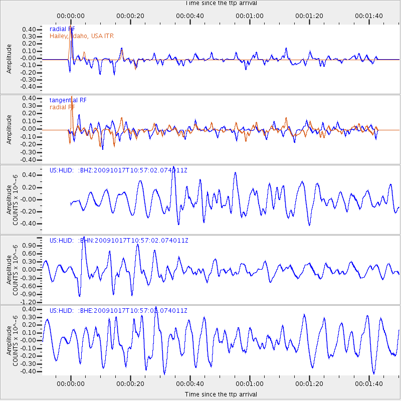
HLID Hailey, Idaho, USA - Earthquake Result Viewer
*The percent match for this event was below the threshold and hence no stack was calculated.
| Earthquake location: |
Samoa Islands Region |
| Earthquake latitude/longitude: |
-16.4/-172.0 |
| Earthquake time(UTC): |
2009/10/17 (290) 10:45:26 GMT |
| Earthquake Depth: |
10 km |
| Earthquake Magnitude: |
5.7 MB, 5.3 MS, 5.7 MW, 5.7 MW |
| Earthquake Catalog/Contributor: |
WHDF/NEIC |
|
| Network: |
US United States National Seismic Network |
| Station: |
HLID Hailey, Idaho, USA |
| Lat/Lon: |
43.56 N/114.41 W |
| Elevation: |
1772 m |
|
| Distance: |
79.5 deg |
| Az: |
38.609 deg |
| Baz: |
235.493 deg |
| Ray Param: |
$rayparam |
*The percent match for this event was below the threshold and hence was not used in the summary stack. |
|
| Radial Match: |
52.923225 % |
| Radial Bump: |
400 |
| Transverse Match: |
46.412033 % |
| Transverse Bump: |
370 |
| SOD ConfigId: |
2622 |
| Insert Time: |
2010-03-05 05:08:15.566 +0000 |
| GWidth: |
2.5 |
| Max Bumps: |
400 |
| Tol: |
0.001 |
|
Signal To Noise
| Channel | StoN | STA | LTA |
| US:HLID: :BHN:20091017T10:57:02.074011Z | 3.4811988 | 6.015833E-7 | 1.7280924E-7 |
| US:HLID: :BHE:20091017T10:57:02.074011Z | 0.8275681 | 1.2978083E-7 | 1.5682193E-7 |
| US:HLID: :BHZ:20091017T10:57:02.074011Z | 1.8279088 | 2.4016077E-7 | 1.3138555E-7 |
| Arrivals |
| Ps | |
| PpPs | |
| PsPs/PpSs | |


