You are here: Home > Network List > TA - USArray Transportable Network (new EarthScope stations) Stations List
> Station WHTX Lake Whitney, Meridian, TX, USA > Earthquake Result Viewer
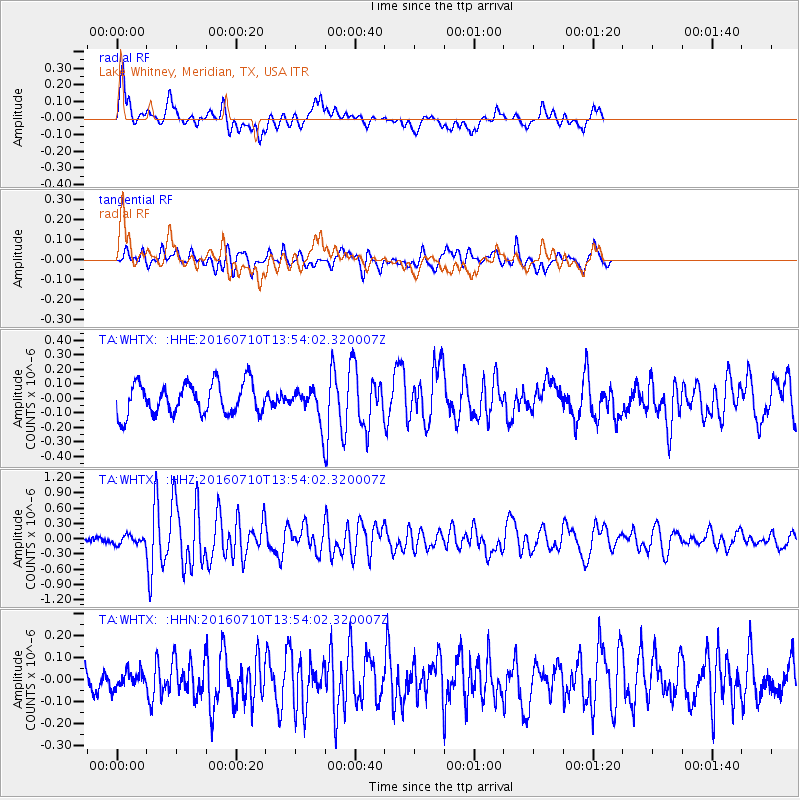
WHTX Lake Whitney, Meridian, TX, USA - Earthquake Result Viewer
*The percent match for this event was below the threshold and hence no stack was calculated.
| Earthquake location: |
Samoa Islands Region |
| Earthquake latitude/longitude: |
-15.0/-172.9 |
| Earthquake time(UTC): |
2016/07/10 (192) 13:41:53 GMT |
| Earthquake Depth: |
10 km |
| Earthquake Magnitude: |
5.5 MB |
| Earthquake Catalog/Contributor: |
NEIC PDE/NEIC ALERT |
|
| Network: |
TA USArray Transportable Network (new EarthScope stations) |
| Station: |
WHTX Lake Whitney, Meridian, TX, USA |
| Lat/Lon: |
31.99 N/97.46 W |
| Elevation: |
190 m |
|
| Distance: |
85.9 deg |
| Az: |
55.53 deg |
| Baz: |
249.625 deg |
| Ray Param: |
$rayparam |
*The percent match for this event was below the threshold and hence was not used in the summary stack. |
|
| Radial Match: |
70.12715 % |
| Radial Bump: |
400 |
| Transverse Match: |
76.43316 % |
| Transverse Bump: |
400 |
| SOD ConfigId: |
11737051 |
| Insert Time: |
2019-04-25 01:00:06.194 +0000 |
| GWidth: |
2.5 |
| Max Bumps: |
400 |
| Tol: |
0.001 |
|
Signal To Noise
| Channel | StoN | STA | LTA |
| TA:WHTX: :HHZ:20160710T13:54:02.320007Z | 1.2116779 | 8.186532E-8 | 6.7563604E-8 |
| TA:WHTX: :HHN:20160710T13:54:02.320007Z | 0.6899252 | 3.722467E-8 | 5.3954647E-8 |
| TA:WHTX: :HHE:20160710T13:54:02.320007Z | 0.5071832 | 5.496728E-8 | 1.0837756E-7 |
| Arrivals |
| Ps | |
| PpPs | |
| PsPs/PpSs | |


