You are here: Home > Network List > US - United States National Seismic Network Stations List
> Station DGMT Dagmar, Montana, USA > Earthquake Result Viewer
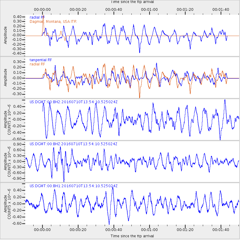
DGMT Dagmar, Montana, USA - Earthquake Result Viewer
*The percent match for this event was below the threshold and hence no stack was calculated.
| Earthquake location: |
Samoa Islands Region |
| Earthquake latitude/longitude: |
-15.0/-172.9 |
| Earthquake time(UTC): |
2016/07/10 (192) 13:41:53 GMT |
| Earthquake Depth: |
10 km |
| Earthquake Magnitude: |
5.5 MB |
| Earthquake Catalog/Contributor: |
NEIC PDE/NEIC ALERT |
|
| Network: |
US United States National Seismic Network |
| Station: |
DGMT Dagmar, Montana, USA |
| Lat/Lon: |
48.47 N/104.20 W |
| Elevation: |
0.0 m |
|
| Distance: |
87.6 deg |
| Az: |
38.352 deg |
| Baz: |
244.27 deg |
| Ray Param: |
$rayparam |
*The percent match for this event was below the threshold and hence was not used in the summary stack. |
|
| Radial Match: |
68.43866 % |
| Radial Bump: |
400 |
| Transverse Match: |
49.25844 % |
| Transverse Bump: |
400 |
| SOD ConfigId: |
11737051 |
| Insert Time: |
2019-04-25 01:00:25.107 +0000 |
| GWidth: |
2.5 |
| Max Bumps: |
400 |
| Tol: |
0.001 |
|
Signal To Noise
| Channel | StoN | STA | LTA |
| US:DGMT:00:BHZ:20160710T13:54:10.525024Z | 1.6917051 | 2.1192514E-7 | 1.2527309E-7 |
| US:DGMT:00:BH1:20160710T13:54:10.525024Z | 0.84121996 | 1.7849892E-7 | 2.1219056E-7 |
| US:DGMT:00:BH2:20160710T13:54:10.525024Z | 1.2182466 | 3.2427283E-7 | 2.6617997E-7 |
| Arrivals |
| Ps | |
| PpPs | |
| PsPs/PpSs | |


