You are here: Home > Network List > US - United States National Seismic Network Stations List
> Station ELK Elko, Nevada, USA > Earthquake Result Viewer
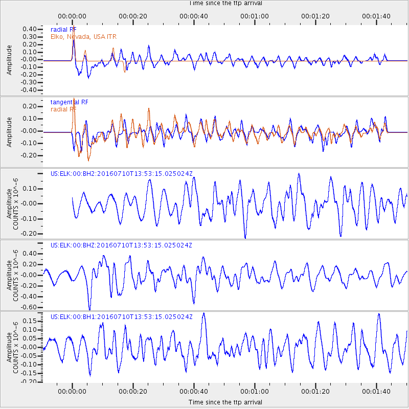
ELK Elko, Nevada, USA - Earthquake Result Viewer
*The percent match for this event was below the threshold and hence no stack was calculated.
| Earthquake location: |
Samoa Islands Region |
| Earthquake latitude/longitude: |
-15.0/-172.9 |
| Earthquake time(UTC): |
2016/07/10 (192) 13:41:53 GMT |
| Earthquake Depth: |
10 km |
| Earthquake Magnitude: |
5.5 MB |
| Earthquake Catalog/Contributor: |
NEIC PDE/NEIC ALERT |
|
| Network: |
US United States National Seismic Network |
| Station: |
ELK Elko, Nevada, USA |
| Lat/Lon: |
40.74 N/115.24 W |
| Elevation: |
2210 m |
|
| Distance: |
77.0 deg |
| Az: |
41.202 deg |
| Baz: |
236.895 deg |
| Ray Param: |
$rayparam |
*The percent match for this event was below the threshold and hence was not used in the summary stack. |
|
| Radial Match: |
68.63336 % |
| Radial Bump: |
400 |
| Transverse Match: |
58.7721 % |
| Transverse Bump: |
400 |
| SOD ConfigId: |
11737051 |
| Insert Time: |
2019-04-25 01:00:28.418 +0000 |
| GWidth: |
2.5 |
| Max Bumps: |
400 |
| Tol: |
0.001 |
|
Signal To Noise
| Channel | StoN | STA | LTA |
| US:ELK:00:BHZ:20160710T13:53:15.025024Z | 1.3721027 | 9.694927E-8 | 7.065744E-8 |
| US:ELK:00:BH1:20160710T13:53:15.025024Z | 0.9571808 | 4.7928413E-8 | 5.007248E-8 |
| US:ELK:00:BH2:20160710T13:53:15.025024Z | 1.1659166 | 6.2354616E-8 | 5.3481198E-8 |
| Arrivals |
| Ps | |
| PpPs | |
| PsPs/PpSs | |


