You are here: Home > Network List > CI - Caltech Regional Seismic Network Stations List
> Station DGR Domenigoni Reservoir, California, USA > Earthquake Result Viewer
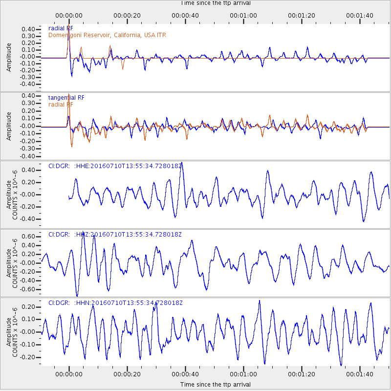
DGR Domenigoni Reservoir, California, USA - Earthquake Result Viewer
*The percent match for this event was below the threshold and hence no stack was calculated.
| Earthquake location: |
Tonga Islands |
| Earthquake latitude/longitude: |
-15.1/-173.2 |
| Earthquake time(UTC): |
2016/07/10 (192) 13:44:41 GMT |
| Earthquake Depth: |
10 km |
| Earthquake Magnitude: |
5.5 MB, 5.8 MWB |
| Earthquake Catalog/Contributor: |
NEIC PDE/NEIC COMCAT |
|
| Network: |
CI Caltech Regional Seismic Network |
| Station: |
DGR Domenigoni Reservoir, California, USA |
| Lat/Lon: |
33.65 N/117.01 W |
| Elevation: |
609 m |
|
| Distance: |
72.2 deg |
| Az: |
46.723 deg |
| Baz: |
237.474 deg |
| Ray Param: |
$rayparam |
*The percent match for this event was below the threshold and hence was not used in the summary stack. |
|
| Radial Match: |
69.67711 % |
| Radial Bump: |
400 |
| Transverse Match: |
63.80384 % |
| Transverse Bump: |
400 |
| SOD ConfigId: |
11737051 |
| Insert Time: |
2019-04-25 01:04:36.795 +0000 |
| GWidth: |
2.5 |
| Max Bumps: |
400 |
| Tol: |
0.001 |
|
Signal To Noise
| Channel | StoN | STA | LTA |
| CI:DGR: :HHZ:20160710T13:55:34.728018Z | 3.5756645 | 3.9557304E-7 | 1.10629244E-7 |
| CI:DGR: :HHN:20160710T13:55:34.728018Z | 1.177768 | 8.8156746E-8 | 7.485068E-8 |
| CI:DGR: :HHE:20160710T13:55:34.728018Z | 1.6578288 | 1.6678953E-7 | 1.0060721E-7 |
| Arrivals |
| Ps | |
| PpPs | |
| PsPs/PpSs | |


