You are here: Home > Network List > TA - USArray Transportable Network (new EarthScope stations) Stations List
> Station D25K Kavik River, AK, USA > Earthquake Result Viewer
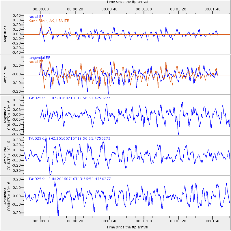
D25K Kavik River, AK, USA - Earthquake Result Viewer
*The percent match for this event was below the threshold and hence no stack was calculated.
| Earthquake location: |
Tonga Islands |
| Earthquake latitude/longitude: |
-15.1/-173.2 |
| Earthquake time(UTC): |
2016/07/10 (192) 13:44:41 GMT |
| Earthquake Depth: |
10 km |
| Earthquake Magnitude: |
5.5 MB, 5.8 MWB |
| Earthquake Catalog/Contributor: |
NEIC PDE/NEIC COMCAT |
|
| Network: |
TA USArray Transportable Network (new EarthScope stations) |
| Station: |
D25K Kavik River, AK, USA |
| Lat/Lon: |
69.32 N/146.38 W |
| Elevation: |
770 m |
|
| Distance: |
86.3 deg |
| Az: |
9.248 deg |
| Baz: |
205.916 deg |
| Ray Param: |
$rayparam |
*The percent match for this event was below the threshold and hence was not used in the summary stack. |
|
| Radial Match: |
71.26103 % |
| Radial Bump: |
400 |
| Transverse Match: |
64.44219 % |
| Transverse Bump: |
400 |
| SOD ConfigId: |
11737051 |
| Insert Time: |
2019-04-25 01:07:40.534 +0000 |
| GWidth: |
2.5 |
| Max Bumps: |
400 |
| Tol: |
0.001 |
|
Signal To Noise
| Channel | StoN | STA | LTA |
| TA:D25K: :BHZ:20160710T13:56:51.475027Z | 2.6249723 | 1.5247326E-7 | 5.8085668E-8 |
| TA:D25K: :BHN:20160710T13:56:51.475027Z | 1.3881496 | 5.650545E-8 | 4.0705586E-8 |
| TA:D25K: :BHE:20160710T13:56:51.475027Z | 1.7884126 | 6.59572E-8 | 3.6880305E-8 |
| Arrivals |
| Ps | |
| PpPs | |
| PsPs/PpSs | |


