You are here: Home > Network List > TA - USArray Transportable Network (new EarthScope stations) Stations List
> Station L19K White Mountain, AK, USA > Earthquake Result Viewer
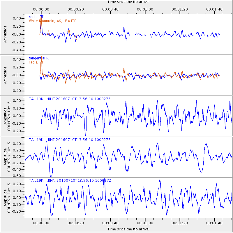
L19K White Mountain, AK, USA - Earthquake Result Viewer
*The percent match for this event was below the threshold and hence no stack was calculated.
| Earthquake location: |
Tonga Islands |
| Earthquake latitude/longitude: |
-15.1/-173.2 |
| Earthquake time(UTC): |
2016/07/10 (192) 13:44:41 GMT |
| Earthquake Depth: |
10 km |
| Earthquake Magnitude: |
5.5 MB, 5.8 MWB |
| Earthquake Catalog/Contributor: |
NEIC PDE/NEIC COMCAT |
|
| Network: |
TA USArray Transportable Network (new EarthScope stations) |
| Station: |
L19K White Mountain, AK, USA |
| Lat/Lon: |
62.18 N/154.85 W |
| Elevation: |
650 m |
|
| Distance: |
78.4 deg |
| Az: |
8.677 deg |
| Baz: |
198.1 deg |
| Ray Param: |
$rayparam |
*The percent match for this event was below the threshold and hence was not used in the summary stack. |
|
| Radial Match: |
70.62335 % |
| Radial Bump: |
400 |
| Transverse Match: |
53.9013 % |
| Transverse Bump: |
400 |
| SOD ConfigId: |
11737051 |
| Insert Time: |
2019-04-25 01:07:57.287 +0000 |
| GWidth: |
2.5 |
| Max Bumps: |
400 |
| Tol: |
0.001 |
|
Signal To Noise
| Channel | StoN | STA | LTA |
| TA:L19K: :BHZ:20160710T13:56:10.100027Z | 2.7149394 | 2.1159711E-7 | 7.793806E-8 |
| TA:L19K: :BHN:20160710T13:56:10.100027Z | 1.1026261 | 9.3735586E-8 | 8.5011216E-8 |
| TA:L19K: :BHE:20160710T13:56:10.100027Z | 1.3178275 | 7.7178704E-8 | 5.8565103E-8 |
| Arrivals |
| Ps | |
| PpPs | |
| PsPs/PpSs | |


