You are here: Home > Network List > TA - USArray Transportable Network (new EarthScope stations) Stations List
> Station A36M Sachs Harbour, NT, CAN > Earthquake Result Viewer
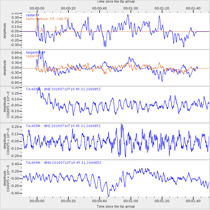
A36M Sachs Harbour, NT, CAN - Earthquake Result Viewer
*The percent match for this event was below the threshold and hence no stack was calculated.
| Earthquake location: |
Vanuatu Islands |
| Earthquake latitude/longitude: |
-14.6/167.4 |
| Earthquake time(UTC): |
2016/07/10 (192) 16:32:49 GMT |
| Earthquake Depth: |
167 km |
| Earthquake Magnitude: |
5.6 MWW, 5.6 MWC, 5.7 MWB |
| Earthquake Catalog/Contributor: |
NEIC PDE/NEIC COMCAT |
|
| Network: |
TA USArray Transportable Network (new EarthScope stations) |
| Station: |
A36M Sachs Harbour, NT, CAN |
| Lat/Lon: |
71.99 N/125.25 W |
| Elevation: |
32 m |
|
| Distance: |
97.1 deg |
| Az: |
16.819 deg |
| Baz: |
244.19 deg |
| Ray Param: |
$rayparam |
*The percent match for this event was below the threshold and hence was not used in the summary stack. |
|
| Radial Match: |
32.56911 % |
| Radial Bump: |
400 |
| Transverse Match: |
36.899227 % |
| Transverse Bump: |
400 |
| SOD ConfigId: |
11737051 |
| Insert Time: |
2019-04-25 01:15:16.097 +0000 |
| GWidth: |
2.5 |
| Max Bumps: |
400 |
| Tol: |
0.001 |
|
Signal To Noise
| Channel | StoN | STA | LTA |
| TA:A36M: :BHZ:20160710T16:45:31.299985Z | 0.6534626 | 4.5526615E-8 | 6.966981E-8 |
| TA:A36M: :BHN:20160710T16:45:31.299985Z | 1.3419449 | 1.2310849E-7 | 9.1738855E-8 |
| TA:A36M: :BHE:20160710T16:45:31.299985Z | 1.1958709 | 1.2716825E-7 | 1.06339456E-7 |
| Arrivals |
| Ps | |
| PpPs | |
| PsPs/PpSs | |


