You are here: Home > Network List > TA - USArray Transportable Network (new EarthScope stations) Stations List
> Station I23K Minto, Yukon-Koyukuk, AK, USA > Earthquake Result Viewer
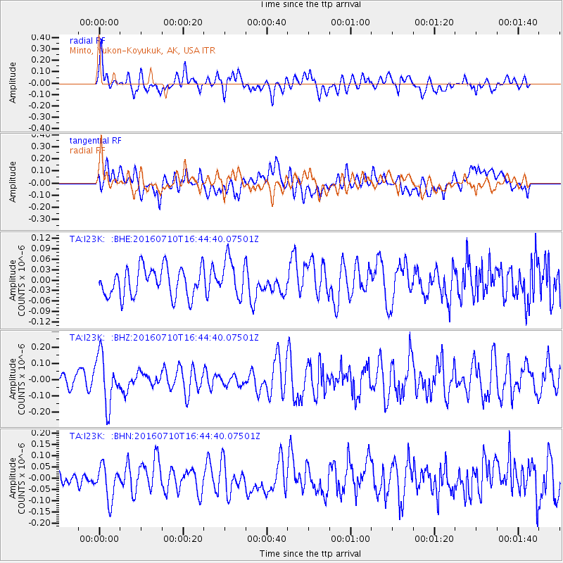
I23K Minto, Yukon-Koyukuk, AK, USA - Earthquake Result Viewer
*The percent match for this event was below the threshold and hence no stack was calculated.
| Earthquake location: |
Vanuatu Islands |
| Earthquake latitude/longitude: |
-14.6/167.4 |
| Earthquake time(UTC): |
2016/07/10 (192) 16:32:49 GMT |
| Earthquake Depth: |
167 km |
| Earthquake Magnitude: |
5.6 MWW, 5.6 MWC, 5.7 MWB |
| Earthquake Catalog/Contributor: |
NEIC PDE/NEIC COMCAT |
|
| Network: |
TA USArray Transportable Network (new EarthScope stations) |
| Station: |
I23K Minto, Yukon-Koyukuk, AK, USA |
| Lat/Lon: |
65.15 N/149.36 W |
| Elevation: |
149 m |
|
| Distance: |
86.0 deg |
| Az: |
16.877 deg |
| Baz: |
221.679 deg |
| Ray Param: |
$rayparam |
*The percent match for this event was below the threshold and hence was not used in the summary stack. |
|
| Radial Match: |
65.5522 % |
| Radial Bump: |
400 |
| Transverse Match: |
53.84124 % |
| Transverse Bump: |
400 |
| SOD ConfigId: |
11737051 |
| Insert Time: |
2019-04-25 01:15:30.258 +0000 |
| GWidth: |
2.5 |
| Max Bumps: |
400 |
| Tol: |
0.001 |
|
Signal To Noise
| Channel | StoN | STA | LTA |
| TA:I23K: :BHZ:20160710T16:44:40.07501Z | 3.9519744 | 1.5499275E-7 | 3.9219064E-8 |
| TA:I23K: :BHN:20160710T16:44:40.07501Z | 1.7538275 | 7.6107966E-8 | 4.3395357E-8 |
| TA:I23K: :BHE:20160710T16:44:40.07501Z | 1.3664826 | 5.6827663E-8 | 4.158682E-8 |
| Arrivals |
| Ps | |
| PpPs | |
| PsPs/PpSs | |


