You are here: Home > Network List > TA - USArray Transportable Network (new EarthScope stations) Stations List
> Station J04D Umpqua National Forest, Toketee, OR, USA > Earthquake Result Viewer
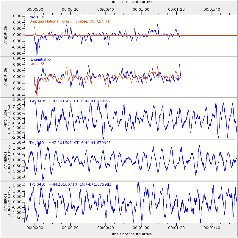
J04D Umpqua National Forest, Toketee, OR, USA - Earthquake Result Viewer
*The percent match for this event was below the threshold and hence no stack was calculated.
| Earthquake location: |
Vanuatu Islands |
| Earthquake latitude/longitude: |
-14.6/167.4 |
| Earthquake time(UTC): |
2016/07/10 (192) 16:32:49 GMT |
| Earthquake Depth: |
167 km |
| Earthquake Magnitude: |
5.6 MWW, 5.6 MWC, 5.7 MWB |
| Earthquake Catalog/Contributor: |
NEIC PDE/NEIC COMCAT |
|
| Network: |
TA USArray Transportable Network (new EarthScope stations) |
| Station: |
J04D Umpqua National Forest, Toketee, OR, USA |
| Lat/Lon: |
43.24 N/122.11 W |
| Elevation: |
1948 m |
|
| Distance: |
86.3 deg |
| Az: |
43.657 deg |
| Baz: |
246.12 deg |
| Ray Param: |
$rayparam |
*The percent match for this event was below the threshold and hence was not used in the summary stack. |
|
| Radial Match: |
64.58126 % |
| Radial Bump: |
400 |
| Transverse Match: |
52.00241 % |
| Transverse Bump: |
400 |
| SOD ConfigId: |
11737051 |
| Insert Time: |
2019-04-25 01:15:31.463 +0000 |
| GWidth: |
2.5 |
| Max Bumps: |
400 |
| Tol: |
0.001 |
|
Signal To Noise
| Channel | StoN | STA | LTA |
| TA:J04D: :HHZ:20160710T16:44:41.67999Z | 2.2186913 | 9.940202E-7 | 4.4802096E-7 |
| TA:J04D: :HHN:20160710T16:44:41.67999Z | 0.9837912 | 9.882576E-7 | 1.00454E-6 |
| TA:J04D: :HHE:20160710T16:44:41.67999Z | 1.1025869 | 8.6793466E-7 | 7.8718034E-7 |
| Arrivals |
| Ps | |
| PpPs | |
| PsPs/PpSs | |


