You are here: Home > Network List > US - United States National Seismic Network Stations List
> Station HAWA Hanford, Washington, USA > Earthquake Result Viewer
HAWA Hanford, Washington, USA - Earthquake Result Viewer

| Earthquake location: |
Sichuan, China |
| Earthquake latitude/longitude: |
31.0/103.3 |
| Earthquake time(UTC): |
2008/05/12 (133) 06:28:01 GMT |
| Earthquake Depth: |
19 km |
| Earthquake Magnitude: |
6.9 MB, 8.1 MS, 7.9 MW, 7.9 MW |
| Earthquake Catalog/Contributor: |
WHDF/NEIC |
|
| Network: |
US United States National Seismic Network |
| Station: |
HAWA Hanford, Washington, USA |
| Lat/Lon: |
46.39 N/119.53 W |
| Elevation: |
364 m |
|
| Distance: |
93.8 deg |
| Az: |
28.149 deg |
| Baz: |
324.177 deg |
| Ray Param: |
0.041191004 |
| Estimated Moho Depth: |
37.5 km |
| Estimated Crust Vp/Vs: |
1.63 |
| Assumed Crust Vp: |
6.419 km/s |
| Estimated Crust Vs: |
3.944 km/s |
| Estimated Crust Poisson's Ratio: |
0.20 |
|
| Radial Match: |
96.0816 % |
| Radial Bump: |
400 |
| Transverse Match: |
89.9847 % |
| Transverse Bump: |
400 |
| SOD ConfigId: |
2504 |
| Insert Time: |
2010-03-05 05:10:18.633 +0000 |
| GWidth: |
2.5 |
| Max Bumps: |
400 |
| Tol: |
0.001 |
|
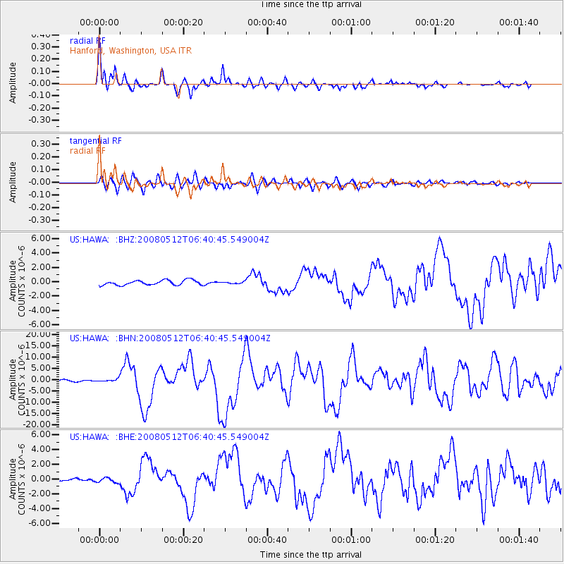
Signal To Noise
| Channel | StoN | STA | LTA |
| US:HAWA: :BHN:20080512T06:40:45.549004Z | 1.5535282 | 6.5492975E-7 | 4.2157572E-7 |
| US:HAWA: :BHE:20080512T06:40:45.549004Z | 1.8518908 | 3.356101E-7 | 1.8122566E-7 |
| US:HAWA: :BHZ:20080512T06:40:45.549004Z | 0.3584124 | 1.2012661E-7 | 3.351631E-7 |
| Arrivals |
| Ps | 3.7 SECOND |
| PpPs | 15 SECOND |
| PsPs/PpSs | 19 SECOND |


