You are here: Home > Network List > US - United States National Seismic Network Stations List
> Station HAWA Hanford, Washington, USA > Earthquake Result Viewer
HAWA Hanford, Washington, USA - Earthquake Result Viewer

| Earthquake location: |
Vanuatu Islands |
| Earthquake latitude/longitude: |
-13.0/166.5 |
| Earthquake time(UTC): |
2009/10/07 (280) 22:03:14 GMT |
| Earthquake Depth: |
45 km |
| Earthquake Magnitude: |
6.4 MB, 7.3 MS, 7.6 MW, 7.7 MW |
| Earthquake Catalog/Contributor: |
WHDF/NEIC |
|
| Network: |
US United States National Seismic Network |
| Station: |
HAWA Hanford, Washington, USA |
| Lat/Lon: |
46.39 N/119.53 W |
| Elevation: |
364 m |
|
| Distance: |
88.6 deg |
| Az: |
41.713 deg |
| Baz: |
249.556 deg |
| Ray Param: |
0.042420518 |
| Estimated Moho Depth: |
33.25 km |
| Estimated Crust Vp/Vs: |
1.87 |
| Assumed Crust Vp: |
6.419 km/s |
| Estimated Crust Vs: |
3.428 km/s |
| Estimated Crust Poisson's Ratio: |
0.30 |
|
| Radial Match: |
93.66765 % |
| Radial Bump: |
356 |
| Transverse Match: |
89.531555 % |
| Transverse Bump: |
333 |
| SOD ConfigId: |
2622 |
| Insert Time: |
2010-03-05 05:11:18.862 +0000 |
| GWidth: |
2.5 |
| Max Bumps: |
400 |
| Tol: |
0.001 |
|
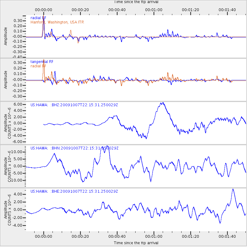
Signal To Noise
| Channel | StoN | STA | LTA |
| US:HAWA: :BHN:20091007T22:15:31.250029Z | 9.108458 | 2.9944956E-6 | 3.2875988E-7 |
| US:HAWA: :BHE:20091007T22:15:31.250029Z | 1.3438717 | 4.800273E-7 | 3.5719725E-7 |
| US:HAWA: :BHZ:20091007T22:15:31.250029Z | 2.6210182 | 5.8159816E-7 | 2.2189779E-7 |
| Arrivals |
| Ps | 4.6 SECOND |
| PpPs | 15 SECOND |
| PsPs/PpSs | 19 SECOND |


