You are here: Home > Network List > US - United States National Seismic Network Stations List
> Station HAWA Hanford, Washington, USA > Earthquake Result Viewer
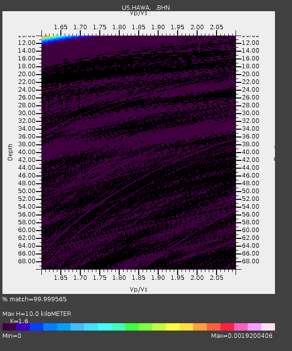
HAWA Hanford, Washington, USA - Earthquake Result Viewer
| Earthquake location: |
Chile-Bolivia Border Region |
| Earthquake latitude/longitude: |
-22.7/-67.9 |
| Earthquake time(UTC): |
2001/06/19 (170) 09:32:24 GMT |
| Earthquake Depth: |
147 km |
| Earthquake Magnitude: |
5.5 MB, 5.2 MS, 6.1 MW, 5.9 MW |
| Earthquake Catalog/Contributor: |
WHDF/NEIC |
|
| Network: |
US United States National Seismic Network |
| Station: |
HAWA Hanford, Washington, USA |
| Lat/Lon: |
46.39 N/119.53 W |
| Elevation: |
364 m |
|
| Distance: |
83.2 deg |
| Az: |
326.857 deg |
| Baz: |
133.177 deg |
| Ray Param: |
0.04604034 |
| Estimated Moho Depth: |
10.0 km |
| Estimated Crust Vp/Vs: |
1.60 |
| Assumed Crust Vp: |
6.419 km/s |
| Estimated Crust Vs: |
4.012 km/s |
| Estimated Crust Poisson's Ratio: |
0.18 |
|
| Radial Match: |
99.999565 % |
| Radial Bump: |
2 |
| Transverse Match: |
99.79729 % |
| Transverse Bump: |
11 |
| SOD ConfigId: |
110165 |
| Insert Time: |
2010-03-05 05:12:48.630 +0000 |
| GWidth: |
2.5 |
| Max Bumps: |
400 |
| Tol: |
0.001 |
|

Signal To Noise
| Channel | StoN | STA | LTA |
| US:HAWA: :BHN:20010619T09:44:03.223Z | 0.9966136 | 3.692372E-7 | 3.7049182E-7 |
| US:HAWA: :BHE:20010619T09:44:03.223Z | 0.9569588 | 4.333452E-7 | 4.5283582E-7 |
| US:HAWA: :BHZ:20010619T09:44:03.223Z | 0.9394625 | 4.3000566E-7 | 4.5771455E-7 |
| Arrivals |
| Ps | 1.0 SECOND |
| PpPs | 3.9 SECOND |
| PsPs/PpSs | 4.9 SECOND |


