HAWA Hanford, Washington, USA - Earthquake Result Viewer
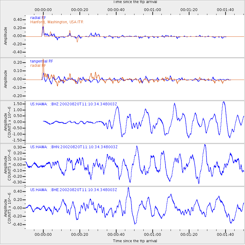
Earthquake location: Southeast Of Honshu, Japan
Earthquake latitude/longitude: 31.0/142.0
Earthquake time(UTC): 2002/08/20 (232) 10:59:32 GMT
Earthquake Depth: 9.0 km
Earthquake Magnitude: 5.4 MB, 6.2 MS, 6.3 MW, 6.1 MW
Earthquake Catalog/Contributor: WHDF/NEIC
Network: US United States National Seismic Network
Station: HAWA Hanford, Washington, USA
Lat/Lon: 46.39 N/119.53 W
Elevation: 364 m
Distance: 73.6 deg
Az: 45.518 deg
Baz: 297.715 deg
Ray Param: 0.052879624
Estimated Moho Depth: 12.5 km
Estimated Crust Vp/Vs: 2.09
Assumed Crust Vp: 6.419 km/s
Estimated Crust Vs: 3.071 km/s
Estimated Crust Poisson's Ratio: 0.35
Radial Match: 92.17325 %
Radial Bump: 366
Transverse Match: 82.12754 %
Transverse Bump: 400
SOD ConfigId: 110165
Insert Time: 2010-03-05 05:12:53.390 +0000
GWidth: 2.5
Max Bumps: 400
Tol: 0.001

Signal To Noise

ChannelStoNSTALTA
US:HAWA: :BHN:20020820T11:10:34.348003Z0.78095422.8291572E-83.622693E-8
US:HAWA: :BHE:20020820T11:10:34.348003Z1.1661174.148902E-83.5578783E-8
US:HAWA: :BHZ:20020820T11:10:34.348003Z1.4467079.875875E-86.826451E-8
Arrivals
Ps2.2 SECOND
PpPs5.8 SECOND
PsPs/PpSs8.0 SECOND