You are here: Home > Network List > TA - USArray Transportable Network (new EarthScope stations) Stations List
> Station K22A Casper, WY, USA > Earthquake Result Viewer
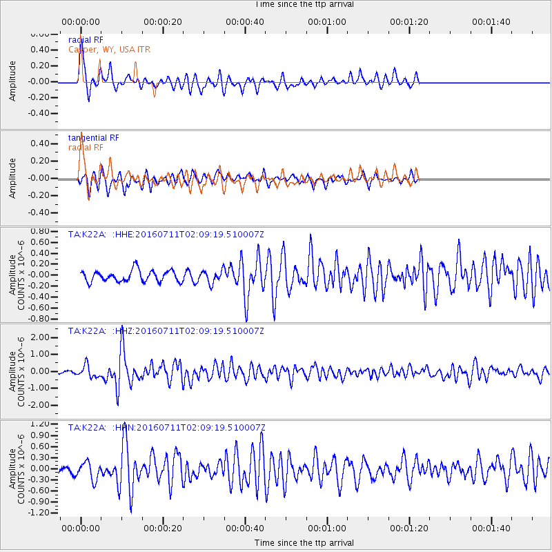
K22A Casper, WY, USA - Earthquake Result Viewer
*The percent match for this event was below the threshold and hence no stack was calculated.
| Earthquake location: |
Near Coast Of Ecuador |
| Earthquake latitude/longitude: |
0.6/-79.6 |
| Earthquake time(UTC): |
2016/07/11 (193) 02:01:09 GMT |
| Earthquake Depth: |
14 km |
| Earthquake Magnitude: |
5.8 MWW, 5.7 MWB, 5.9 MWC |
| Earthquake Catalog/Contributor: |
NEIC PDE/NEIC COMCAT |
|
| Network: |
TA USArray Transportable Network (new EarthScope stations) |
| Station: |
K22A Casper, WY, USA |
| Lat/Lon: |
42.65 N/106.52 W |
| Elevation: |
1686 m |
|
| Distance: |
48.3 deg |
| Az: |
333.483 deg |
| Baz: |
142.762 deg |
| Ray Param: |
$rayparam |
*The percent match for this event was below the threshold and hence was not used in the summary stack. |
|
| Radial Match: |
79.17769 % |
| Radial Bump: |
336 |
| Transverse Match: |
66.13947 % |
| Transverse Bump: |
311 |
| SOD ConfigId: |
11737051 |
| Insert Time: |
2019-04-25 01:27:47.733 +0000 |
| GWidth: |
2.5 |
| Max Bumps: |
400 |
| Tol: |
0.001 |
|
Signal To Noise
| Channel | StoN | STA | LTA |
| TA:K22A: :HHZ:20160711T02:09:19.510007Z | 7.1580443 | 3.6815717E-7 | 5.143265E-8 |
| TA:K22A: :HHN:20160711T02:09:19.510007Z | 2.7919922 | 2.4635105E-7 | 8.8234856E-8 |
| TA:K22A: :HHE:20160711T02:09:19.510007Z | 1.1122036 | 1.13868786E-7 | 1.0238124E-7 |
| Arrivals |
| Ps | |
| PpPs | |
| PsPs/PpSs | |


