You are here: Home > Network List > TA - USArray Transportable Network (new EarthScope stations) Stations List
> Station O18K Koktuh Hills, AK, USA > Earthquake Result Viewer
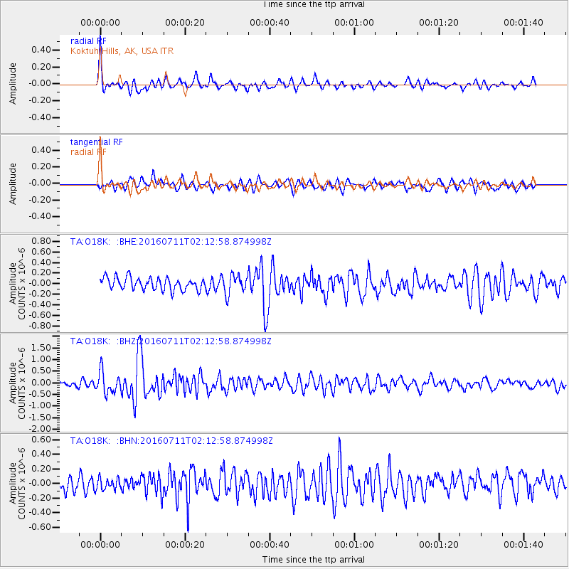
O18K Koktuh Hills, AK, USA - Earthquake Result Viewer
*The percent match for this event was below the threshold and hence no stack was calculated.
| Earthquake location: |
Near Coast Of Ecuador |
| Earthquake latitude/longitude: |
0.6/-79.6 |
| Earthquake time(UTC): |
2016/07/11 (193) 02:01:09 GMT |
| Earthquake Depth: |
14 km |
| Earthquake Magnitude: |
5.8 MWW, 5.7 MWB, 5.9 MWC |
| Earthquake Catalog/Contributor: |
NEIC PDE/NEIC COMCAT |
|
| Network: |
TA USArray Transportable Network (new EarthScope stations) |
| Station: |
O18K Koktuh Hills, AK, USA |
| Lat/Lon: |
59.85 N/155.21 W |
| Elevation: |
544 m |
|
| Distance: |
82.3 deg |
| Az: |
330.445 deg |
| Baz: |
102.248 deg |
| Ray Param: |
$rayparam |
*The percent match for this event was below the threshold and hence was not used in the summary stack. |
|
| Radial Match: |
78.80075 % |
| Radial Bump: |
400 |
| Transverse Match: |
78.233864 % |
| Transverse Bump: |
400 |
| SOD ConfigId: |
11737051 |
| Insert Time: |
2019-04-25 01:28:13.794 +0000 |
| GWidth: |
2.5 |
| Max Bumps: |
400 |
| Tol: |
0.001 |
|
Signal To Noise
| Channel | StoN | STA | LTA |
| TA:O18K: :BHZ:20160711T02:12:58.874998Z | 5.8026304 | 4.7473273E-7 | 8.181337E-8 |
| TA:O18K: :BHN:20160711T02:12:58.874998Z | 0.8471484 | 7.4414416E-8 | 8.784106E-8 |
| TA:O18K: :BHE:20160711T02:12:58.874998Z | 1.5762458 | 1.8017633E-7 | 1.1430725E-7 |
| Arrivals |
| Ps | |
| PpPs | |
| PsPs/PpSs | |


