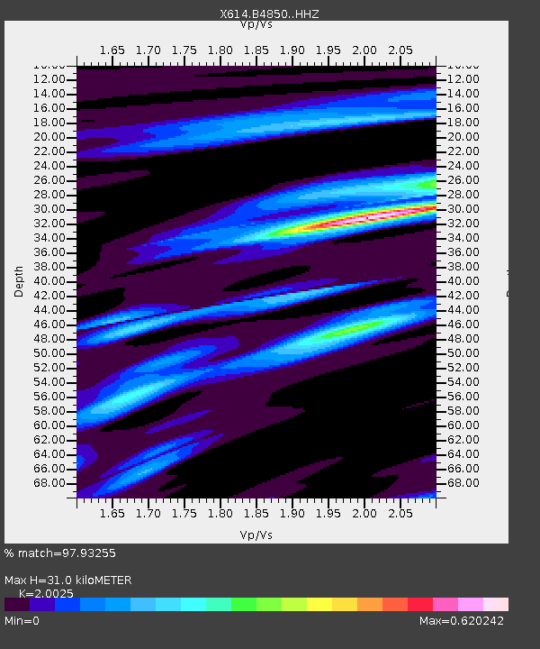
B4850 4850 level Homestake mine - near shaft 6 - Earthquake Result Viewer

Earthquake location: Near Coast Of Ecuador
Earthquake latitude/longitude: 0.6/-79.6
Earthquake time(UTC): 2016/07/11 (193) 02:01:09 GMT
Earthquake Depth: 14 km
Earthquake Magnitude: 5.8 MWW, 5.7 MWB, 5.9 MWC
Earthquake Catalog/Contributor: NEIC PDE/NEIC COMCAT
Network: X6 Homestake Gold Mine Three dimensional Broadband Array
Station: B4850 4850 level Homestake mine - near shaft 6
Lat/Lon: 44.35 N/103.76 W
Elevation: 115 m
Distance: 48.6 deg
Az: 336.986 deg
Baz: 146.983 deg
Ray Param: 0.06926565
Estimated Moho Depth: 31.0 km
Estimated Crust Vp/Vs: 2.00
Assumed Crust Vp: 6.242 km/s
Estimated Crust Vs: 3.117 km/s
Estimated Crust Poisson's Ratio: 0.33
Radial Match: 97.93255 %
Radial Bump: 235
Transverse Match: 93.40369 %
Transverse Bump: 400
SOD ConfigId: 11737051
Insert Time: 2019-04-25 01:29:32.859 +0000
GWidth: 2.5
Max Bumps: 400
Tol: 0.001

Signal To Noise

ChannelStoNSTALTA
X6:B4850: :HHZ:20160711T02:09:21.260007Z17.2458441.0627915E-66.1625954E-8
X6:B4850: :HHN:20160711T02:09:21.260007Z7.0283543.3950536E-74.83051E-8
X6:B4850: :HHE:20160711T02:09:21.260007Z11.0860923.4550112E-73.116528E-8
Arrivals
Ps5.2 SECOND
PpPs14 SECOND
PsPs/PpSs19 SECOND