HAWA Hanford, Washington, USA - Earthquake Result Viewer
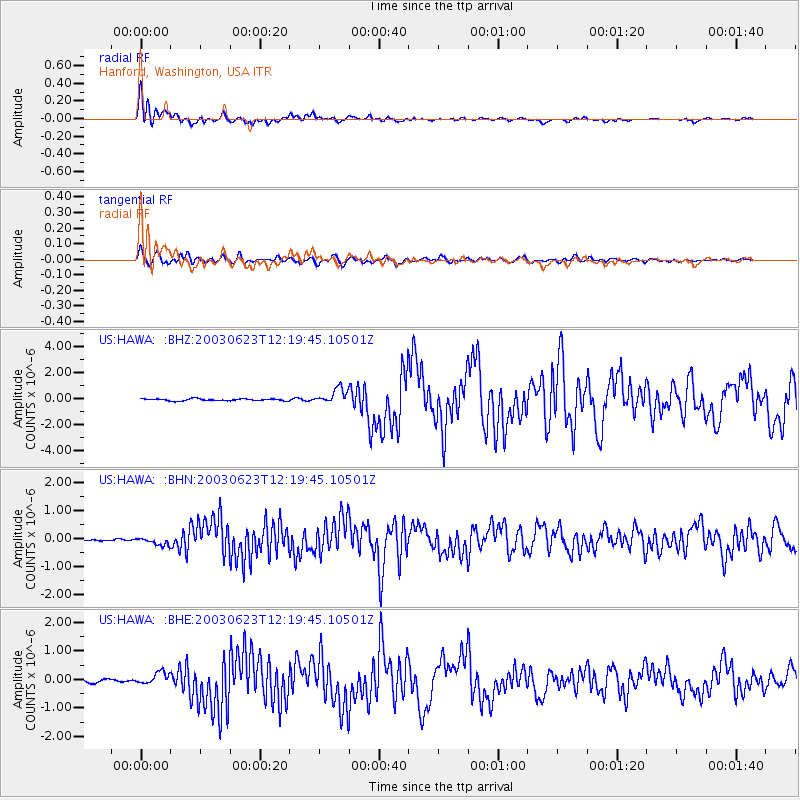
Earthquake location: Rat Islands, Aleutian Islands
Earthquake latitude/longitude: 51.4/176.8
Earthquake time(UTC): 2003/06/23 (174) 12:12:34 GMT
Earthquake Depth: 20 km
Earthquake Magnitude: 6.3 MB, 7.0 MS, 6.9 MW, 6.8 MW
Earthquake Catalog/Contributor: WHDF/NEIC
Network: US United States National Seismic Network
Station: HAWA Hanford, Washington, USA
Lat/Lon: 46.39 N/119.53 W
Elevation: 364 m
Distance: 41.0 deg
Az: 71.097 deg
Baz: 301.181 deg
Ray Param: 0.074051864
Estimated Moho Depth: 36.0 km
Estimated Crust Vp/Vs: 1.67
Assumed Crust Vp: 6.419 km/s
Estimated Crust Vs: 3.85 km/s
Estimated Crust Poisson's Ratio: 0.22
Radial Match: 95.313896 %
Radial Bump: 400
Transverse Match: 81.60512 %
Transverse Bump: 400
SOD ConfigId: 110177
Insert Time: 2010-03-05 05:14:21.209 +0000
GWidth: 2.5
Max Bumps: 400
Tol: 0.001

Signal To Noise

ChannelStoNSTALTA
US:HAWA: :BHN:20030623T12:19:45.10501Z3.0508731.401342E-74.5932495E-8
US:HAWA: :BHE:20030623T12:19:45.10501Z5.1061182.1409576E-74.1929262E-8
US:HAWA: :BHZ:20030623T12:19:45.10501Z7.95604375.915622E-77.4353814E-8
Arrivals
Ps4.0 SECOND
PpPs14 SECOND
PsPs/PpSs18 SECOND