You are here: Home > Network List > US - United States National Seismic Network Stations List
> Station HAWA Hanford, Washington, USA > Earthquake Result Viewer
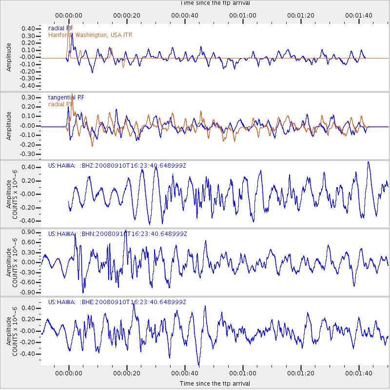
HAWA Hanford, Washington, USA - Earthquake Result Viewer
*The percent match for this event was below the threshold and hence no stack was calculated.
| Earthquake location: |
Northern Chile |
| Earthquake latitude/longitude: |
-20.3/-69.2 |
| Earthquake time(UTC): |
2008/09/10 (254) 16:12:04 GMT |
| Earthquake Depth: |
38 km |
| Earthquake Magnitude: |
5.6 MB, 5.3 MS |
| Earthquake Catalog/Contributor: |
WHDF/NEIC |
|
| Network: |
US United States National Seismic Network |
| Station: |
HAWA Hanford, Washington, USA |
| Lat/Lon: |
46.39 N/119.53 W |
| Elevation: |
364 m |
|
| Distance: |
80.4 deg |
| Az: |
327.307 deg |
| Baz: |
132.888 deg |
| Ray Param: |
$rayparam |
*The percent match for this event was below the threshold and hence was not used in the summary stack. |
|
| Radial Match: |
61.311665 % |
| Radial Bump: |
400 |
| Transverse Match: |
53.059414 % |
| Transverse Bump: |
400 |
| SOD ConfigId: |
2560 |
| Insert Time: |
2010-03-05 05:14:41.149 +0000 |
| GWidth: |
2.5 |
| Max Bumps: |
400 |
| Tol: |
0.001 |
|
Signal To Noise
| Channel | StoN | STA | LTA |
| US:HAWA: :BHN:20080910T16:23:40.648999Z | 3.7339733 | 3.8487158E-7 | 1.03072935E-7 |
| US:HAWA: :BHE:20080910T16:23:40.648999Z | 1.5355582 | 1.9117668E-7 | 1.2449979E-7 |
| US:HAWA: :BHZ:20080910T16:23:40.648999Z | 1.7400447 | 2.5069238E-7 | 1.4407239E-7 |
| Arrivals |
| Ps | |
| PpPs | |
| PsPs/PpSs | |


