You are here: Home > Network List > US - United States National Seismic Network Stations List
> Station HAWA Hanford, Washington, USA > Earthquake Result Viewer
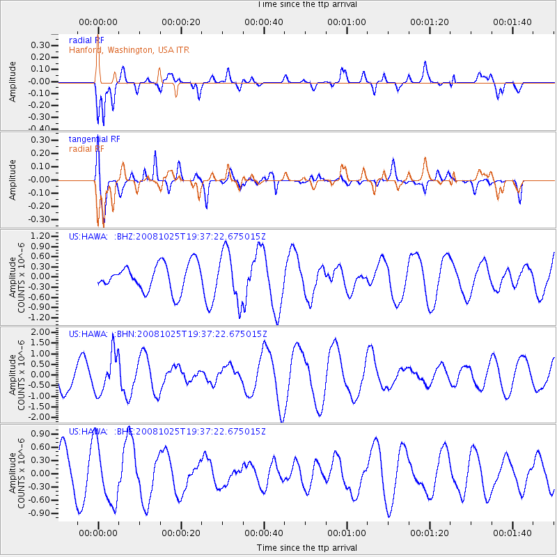
HAWA Hanford, Washington, USA - Earthquake Result Viewer
*The percent match for this event was below the threshold and hence no stack was calculated.
| Earthquake location: |
Vanuatu Islands |
| Earthquake latitude/longitude: |
-17.2/167.3 |
| Earthquake time(UTC): |
2008/10/25 (299) 19:24:50 GMT |
| Earthquake Depth: |
23 km |
| Earthquake Magnitude: |
5.7 MB, 5.3 MS, 5.7 MW, 5.7 MW |
| Earthquake Catalog/Contributor: |
WHDF/NEIC |
|
| Network: |
US United States National Seismic Network |
| Station: |
HAWA Hanford, Washington, USA |
| Lat/Lon: |
46.39 N/119.53 W |
| Elevation: |
364 m |
|
| Distance: |
91.2 deg |
| Az: |
41.513 deg |
| Baz: |
246.231 deg |
| Ray Param: |
$rayparam |
*The percent match for this event was below the threshold and hence was not used in the summary stack. |
|
| Radial Match: |
62.121014 % |
| Radial Bump: |
400 |
| Transverse Match: |
72.51573 % |
| Transverse Bump: |
400 |
| SOD ConfigId: |
2560 |
| Insert Time: |
2010-03-05 05:14:42.315 +0000 |
| GWidth: |
2.5 |
| Max Bumps: |
400 |
| Tol: |
0.001 |
|
Signal To Noise
| Channel | StoN | STA | LTA |
| US:HAWA: :BHN:20081025T19:37:22.675015Z | 1.268489 | 9.5297804E-7 | 7.512703E-7 |
| US:HAWA: :BHE:20081025T19:37:22.675015Z | 1.5727562 | 6.691186E-7 | 4.2544335E-7 |
| US:HAWA: :BHZ:20081025T19:37:22.675015Z | 1.9240147 | 7.5318314E-7 | 3.9146434E-7 |
| Arrivals |
| Ps | |
| PpPs | |
| PsPs/PpSs | |


