You are here: Home > Network List > US - United States National Seismic Network Stations List
> Station HAWA Hanford, Washington, USA > Earthquake Result Viewer
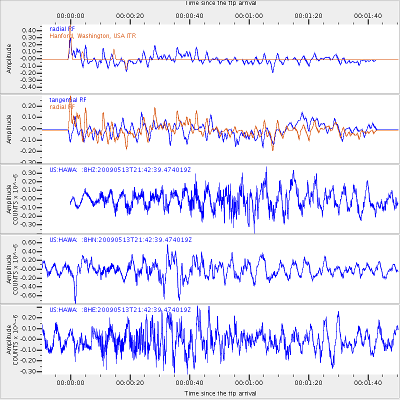
HAWA Hanford, Washington, USA - Earthquake Result Viewer
*The percent match for this event was below the threshold and hence no stack was calculated.
| Earthquake location: |
Tonga Islands |
| Earthquake latitude/longitude: |
-15.8/-173.5 |
| Earthquake time(UTC): |
2009/05/13 (133) 21:31:17 GMT |
| Earthquake Depth: |
85 km |
| Earthquake Magnitude: |
5.8 MW, 5.3 MB, 5.8 MW |
| Earthquake Catalog/Contributor: |
WHDF/NEIC |
|
| Network: |
US United States National Seismic Network |
| Station: |
HAWA Hanford, Washington, USA |
| Lat/Lon: |
46.39 N/119.53 W |
| Elevation: |
364 m |
|
| Distance: |
78.6 deg |
| Az: |
34.812 deg |
| Baz: |
232.584 deg |
| Ray Param: |
$rayparam |
*The percent match for this event was below the threshold and hence was not used in the summary stack. |
|
| Radial Match: |
52.84972 % |
| Radial Bump: |
400 |
| Transverse Match: |
50.487614 % |
| Transverse Bump: |
400 |
| SOD ConfigId: |
2760 |
| Insert Time: |
2010-03-05 05:14:47.222 +0000 |
| GWidth: |
2.5 |
| Max Bumps: |
400 |
| Tol: |
0.001 |
|
Signal To Noise
| Channel | StoN | STA | LTA |
| US:HAWA: :BHN:20090513T21:42:39.474019Z | 2.8032768 | 2.653669E-7 | 9.466312E-8 |
| US:HAWA: :BHE:20090513T21:42:39.474019Z | 0.9579493 | 6.752984E-8 | 7.049417E-8 |
| US:HAWA: :BHZ:20090513T21:42:39.474019Z | 1.2189742 | 7.782675E-8 | 6.3846095E-8 |
| Arrivals |
| Ps | |
| PpPs | |
| PsPs/PpSs | |


