You are here: Home > Network List > US - United States National Seismic Network Stations List
> Station HAWA Hanford, Washington, USA > Earthquake Result Viewer
HAWA Hanford, Washington, USA - Earthquake Result Viewer
*The percent match for this event was below the threshold and hence no stack was calculated.
| Earthquake location: |
Kermadec Islands Region |
| Earthquake latitude/longitude: |
-31.5/-178.8 |
| Earthquake time(UTC): |
2009/05/16 (136) 00:53:52 GMT |
| Earthquake Depth: |
55 km |
| Earthquake Magnitude: |
6.1 MB, 6.5 MW, 6.3 MW |
| Earthquake Catalog/Contributor: |
WHDF/NEIC |
|
| Network: |
US United States National Seismic Network |
| Station: |
HAWA Hanford, Washington, USA |
| Lat/Lon: |
46.39 N/119.53 W |
| Elevation: |
364 m |
|
| Distance: |
94.2 deg |
| Az: |
36.619 deg |
| Baz: |
227.392 deg |
| Ray Param: |
$rayparam |
*The percent match for this event was below the threshold and hence was not used in the summary stack. |
|
| Radial Match: |
70.94828 % |
| Radial Bump: |
400 |
| Transverse Match: |
69.53366 % |
| Transverse Bump: |
400 |
| SOD ConfigId: |
2760 |
| Insert Time: |
2010-03-05 05:14:48.263 +0000 |
| GWidth: |
2.5 |
| Max Bumps: |
400 |
| Tol: |
0.001 |
|
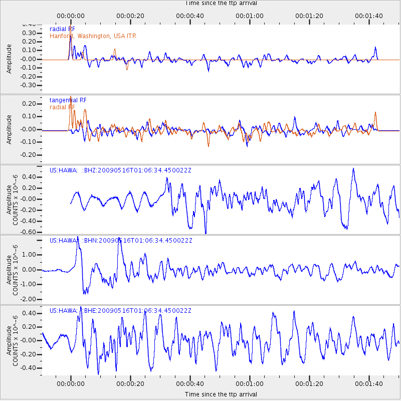
Signal To Noise
| Channel | StoN | STA | LTA |
| US:HAWA: :BHN:20090516T01:06:34.450022Z | 8.516125 | 1.1048077E-6 | 1.2973128E-7 |
| US:HAWA: :BHE:20090516T01:06:34.450022Z | 2.965366 | 2.2867854E-7 | 7.711647E-8 |
| US:HAWA: :BHZ:20090516T01:06:34.450022Z | 2.2238364 | 2.007858E-7 | 9.0288026E-8 |
| Arrivals |
| Ps | |
| PpPs | |
| PsPs/PpSs | |


