You are here: Home > Network List > US - United States National Seismic Network Stations List
> Station HAWA Hanford, Washington, USA > Earthquake Result Viewer
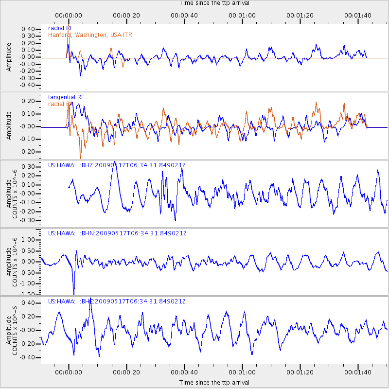
HAWA Hanford, Washington, USA - Earthquake Result Viewer
*The percent match for this event was below the threshold and hence no stack was calculated.
| Earthquake location: |
Tonga Islands |
| Earthquake latitude/longitude: |
-16.8/-173.5 |
| Earthquake time(UTC): |
2009/05/17 (137) 06:23:03 GMT |
| Earthquake Depth: |
67 km |
| Earthquake Magnitude: |
5.5 MB, 5.6 MW, 5.6 MW |
| Earthquake Catalog/Contributor: |
WHDF/NEIC |
|
| Network: |
US United States National Seismic Network |
| Station: |
HAWA Hanford, Washington, USA |
| Lat/Lon: |
46.39 N/119.53 W |
| Elevation: |
364 m |
|
| Distance: |
79.5 deg |
| Az: |
34.695 deg |
| Baz: |
231.964 deg |
| Ray Param: |
$rayparam |
*The percent match for this event was below the threshold and hence was not used in the summary stack. |
|
| Radial Match: |
57.029156 % |
| Radial Bump: |
400 |
| Transverse Match: |
48.79522 % |
| Transverse Bump: |
400 |
| SOD ConfigId: |
2760 |
| Insert Time: |
2010-03-05 05:14:49.047 +0000 |
| GWidth: |
2.5 |
| Max Bumps: |
400 |
| Tol: |
0.001 |
|
Signal To Noise
| Channel | StoN | STA | LTA |
| US:HAWA: :BHN:20090517T06:34:31.849021Z | 3.638755 | 4.6236096E-7 | 1.270657E-7 |
| US:HAWA: :BHE:20090517T06:34:31.849021Z | 1.0067407 | 1.3619963E-7 | 1.352877E-7 |
| US:HAWA: :BHZ:20090517T06:34:31.849021Z | 0.8138575 | 1.0942218E-7 | 1.3444883E-7 |
| Arrivals |
| Ps | |
| PpPs | |
| PsPs/PpSs | |


