You are here: Home > Network List > US - United States National Seismic Network Stations List
> Station HAWA Hanford, Washington, USA > Earthquake Result Viewer
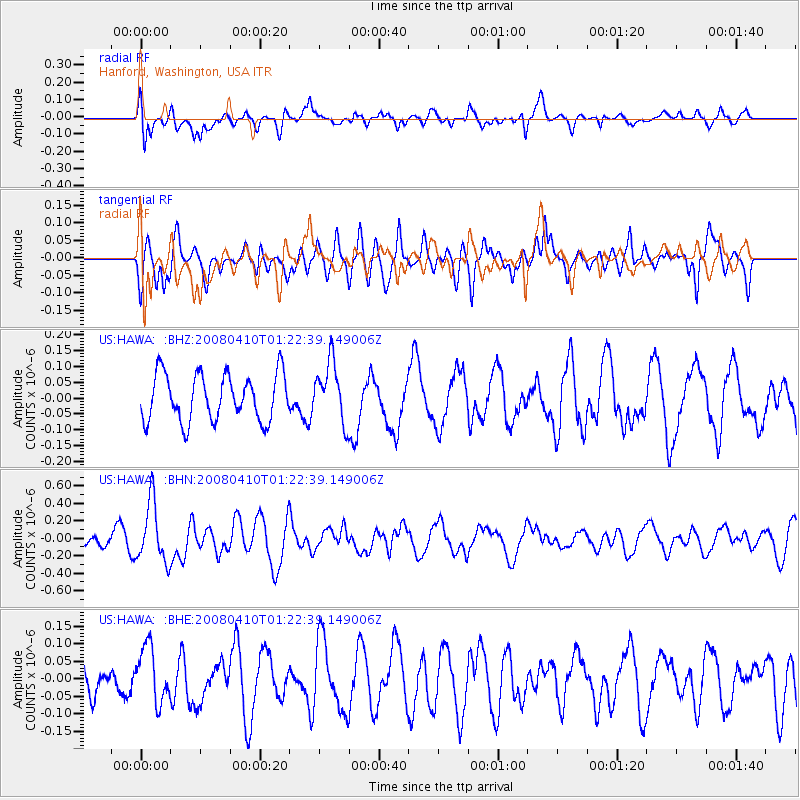
HAWA Hanford, Washington, USA - Earthquake Result Viewer
*The percent match for this event was below the threshold and hence no stack was calculated.
| Earthquake location: |
Loyalty Islands |
| Earthquake latitude/longitude: |
-20.3/168.9 |
| Earthquake time(UTC): |
2008/04/10 (101) 01:10:02 GMT |
| Earthquake Depth: |
35 km |
| Earthquake Magnitude: |
5.5 MB, 5.5 MS, 5.8 MW |
| Earthquake Catalog/Contributor: |
WHDF/NEIC |
|
| Network: |
US United States National Seismic Network |
| Station: |
HAWA Hanford, Washington, USA |
| Lat/Lon: |
46.39 N/119.53 W |
| Elevation: |
364 m |
|
| Distance: |
92.5 deg |
| Az: |
41.08 deg |
| Baz: |
242.993 deg |
| Ray Param: |
$rayparam |
*The percent match for this event was below the threshold and hence was not used in the summary stack. |
|
| Radial Match: |
48.584957 % |
| Radial Bump: |
400 |
| Transverse Match: |
51.261852 % |
| Transverse Bump: |
400 |
| SOD ConfigId: |
2504 |
| Insert Time: |
2010-03-05 05:14:52.637 +0000 |
| GWidth: |
2.5 |
| Max Bumps: |
400 |
| Tol: |
0.001 |
|
Signal To Noise
| Channel | StoN | STA | LTA |
| US:HAWA: :BHN:20080410T01:22:39.149006Z | 2.6080406 | 3.4289528E-7 | 1.3147621E-7 |
| US:HAWA: :BHE:20080410T01:22:39.149006Z | 1.1385518 | 7.949399E-8 | 6.982026E-8 |
| US:HAWA: :BHZ:20080410T01:22:39.149006Z | 1.2847769 | 9.4964136E-8 | 7.391488E-8 |
| Arrivals |
| Ps | |
| PpPs | |
| PsPs/PpSs | |


