You are here: Home > Network List > US - United States National Seismic Network Stations List
> Station HAWA Hanford, Washington, USA > Earthquake Result Viewer
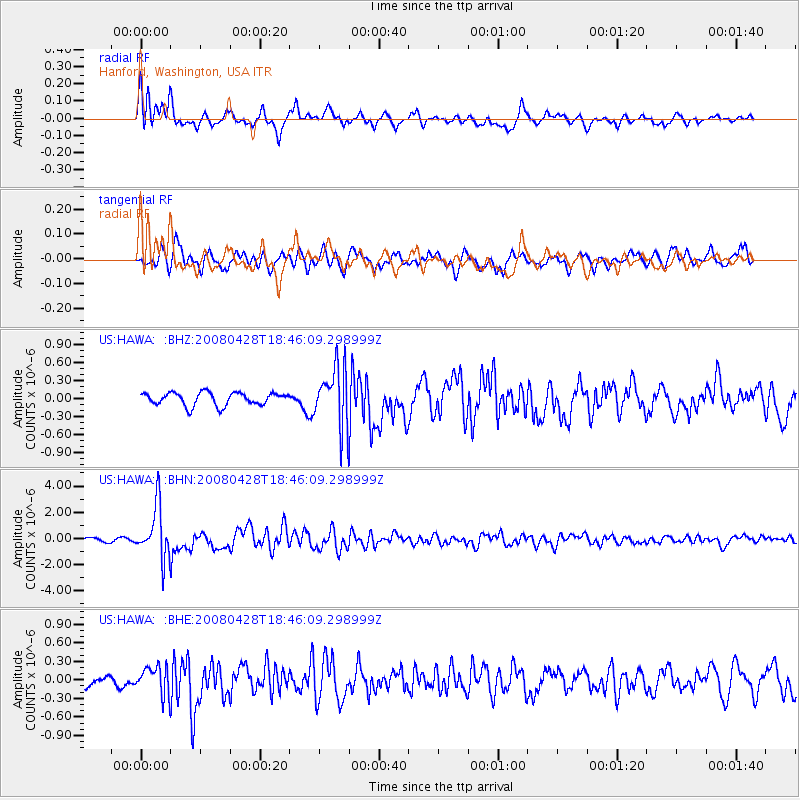
HAWA Hanford, Washington, USA - Earthquake Result Viewer
*The percent match for this event was below the threshold and hence no stack was calculated.
| Earthquake location: |
Vanuatu Islands |
| Earthquake latitude/longitude: |
-19.9/169.0 |
| Earthquake time(UTC): |
2008/04/28 (119) 18:33:34 GMT |
| Earthquake Depth: |
32 km |
| Earthquake Magnitude: |
6.2 MB, 6.2 MS, 6.4 MW, 6.4 MW |
| Earthquake Catalog/Contributor: |
WHDF/NEIC |
|
| Network: |
US United States National Seismic Network |
| Station: |
HAWA Hanford, Washington, USA |
| Lat/Lon: |
46.39 N/119.53 W |
| Elevation: |
364 m |
|
| Distance: |
92.2 deg |
| Az: |
41.064 deg |
| Baz: |
243.238 deg |
| Ray Param: |
$rayparam |
*The percent match for this event was below the threshold and hence was not used in the summary stack. |
|
| Radial Match: |
73.60067 % |
| Radial Bump: |
400 |
| Transverse Match: |
77.22044 % |
| Transverse Bump: |
400 |
| SOD ConfigId: |
2504 |
| Insert Time: |
2010-03-05 05:14:55.584 +0000 |
| GWidth: |
2.5 |
| Max Bumps: |
400 |
| Tol: |
0.001 |
|
Signal To Noise
| Channel | StoN | STA | LTA |
| US:HAWA: :BHN:20080428T18:46:09.298999Z | 6.5377774 | 1.9862227E-6 | 3.0380704E-7 |
| US:HAWA: :BHE:20080428T18:46:09.298999Z | 2.248006 | 2.1923641E-7 | 9.752483E-8 |
| US:HAWA: :BHZ:20080428T18:46:09.298999Z | 4.565115 | 4.928561E-7 | 1.0796137E-7 |
| Arrivals |
| Ps | |
| PpPs | |
| PsPs/PpSs | |


