You are here: Home > Network List > US - United States National Seismic Network Stations List
> Station HAWA Hanford, Washington, USA > Earthquake Result Viewer
HAWA Hanford, Washington, USA - Earthquake Result Viewer
*The percent match for this event was below the threshold and hence no stack was calculated.
| Earthquake location: |
South Of Panama |
| Earthquake latitude/longitude: |
5.0/-82.7 |
| Earthquake time(UTC): |
2008/06/17 (169) 17:42:09 GMT |
| Earthquake Depth: |
10 km |
| Earthquake Magnitude: |
5.6 MB, 5.3 MS, 5.9 MW, 5.9 MW |
| Earthquake Catalog/Contributor: |
WHDF/NEIC |
|
| Network: |
US United States National Seismic Network |
| Station: |
HAWA Hanford, Washington, USA |
| Lat/Lon: |
46.39 N/119.53 W |
| Elevation: |
364 m |
|
| Distance: |
52.1 deg |
| Az: |
328.242 deg |
| Baz: |
130.748 deg |
| Ray Param: |
$rayparam |
*The percent match for this event was below the threshold and hence was not used in the summary stack. |
|
| Radial Match: |
71.04872 % |
| Radial Bump: |
400 |
| Transverse Match: |
62.472748 % |
| Transverse Bump: |
400 |
| SOD ConfigId: |
2504 |
| Insert Time: |
2010-03-05 05:15:02.970 +0000 |
| GWidth: |
2.5 |
| Max Bumps: |
400 |
| Tol: |
0.001 |
|
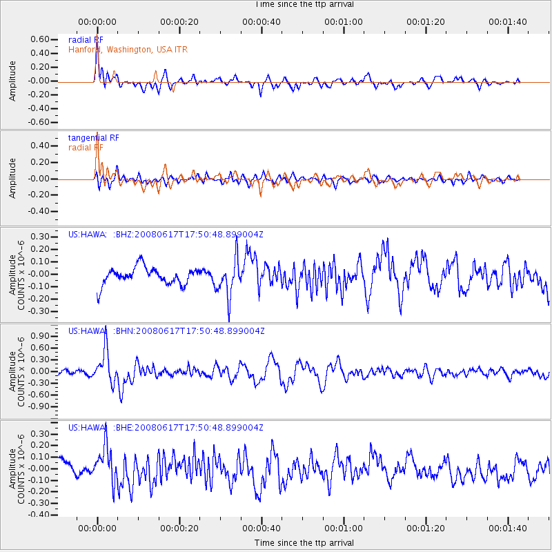
Signal To Noise
| Channel | StoN | STA | LTA |
| US:HAWA: :BHN:20080617T17:50:48.899004Z | 5.4488835 | 4.3270688E-7 | 7.9412025E-8 |
| US:HAWA: :BHE:20080617T17:50:48.899004Z | 2.27905 | 1.5998958E-7 | 7.0200116E-8 |
| US:HAWA: :BHZ:20080617T17:50:48.899004Z | 2.194828 | 1.4840641E-7 | 6.761642E-8 |
| Arrivals |
| Ps | |
| PpPs | |
| PsPs/PpSs | |


