You are here: Home > Network List > US - United States National Seismic Network Stations List
> Station HAWA Hanford, Washington, USA > Earthquake Result Viewer
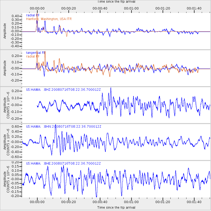
HAWA Hanford, Washington, USA - Earthquake Result Viewer
*The percent match for this event was below the threshold and hence no stack was calculated.
| Earthquake location: |
Samoa Islands Region |
| Earthquake latitude/longitude: |
-16.6/-173.0 |
| Earthquake time(UTC): |
2008/07/16 (198) 08:11:04 GMT |
| Earthquake Depth: |
10 km |
| Earthquake Magnitude: |
5.5 MB, 5.4 MS, 5.7 MW, 5.7 MW |
| Earthquake Catalog/Contributor: |
WHDF/NEIC |
|
| Network: |
US United States National Seismic Network |
| Station: |
HAWA Hanford, Washington, USA |
| Lat/Lon: |
46.39 N/119.53 W |
| Elevation: |
364 m |
|
| Distance: |
79.0 deg |
| Az: |
34.489 deg |
| Baz: |
231.67 deg |
| Ray Param: |
$rayparam |
*The percent match for this event was below the threshold and hence was not used in the summary stack. |
|
| Radial Match: |
74.97206 % |
| Radial Bump: |
400 |
| Transverse Match: |
62.76647 % |
| Transverse Bump: |
400 |
| SOD ConfigId: |
2504 |
| Insert Time: |
2010-03-05 05:15:11.161 +0000 |
| GWidth: |
2.5 |
| Max Bumps: |
400 |
| Tol: |
0.001 |
|
Signal To Noise
| Channel | StoN | STA | LTA |
| US:HAWA: :BHN:20080716T08:22:36.700012Z | 2.2956054 | 1.4232033E-7 | 6.1996865E-8 |
| US:HAWA: :BHE:20080716T08:22:36.700012Z | 1.3599552 | 5.153823E-8 | 3.7897006E-8 |
| US:HAWA: :BHZ:20080716T08:22:36.700012Z | 0.81205916 | 3.4721307E-8 | 4.275712E-8 |
| Arrivals |
| Ps | |
| PpPs | |
| PsPs/PpSs | |


