You are here: Home > Network List > US - United States National Seismic Network Stations List
> Station HAWA Hanford, Washington, USA > Earthquake Result Viewer
HAWA Hanford, Washington, USA - Earthquake Result Viewer
*The percent match for this event was below the threshold and hence no stack was calculated.
| Earthquake location: |
North Of Severnaya Zemlya |
| Earthquake latitude/longitude: |
83.6/115.2 |
| Earthquake time(UTC): |
2008/08/13 (226) 08:35:02 GMT |
| Earthquake Depth: |
10 km |
| Earthquake Magnitude: |
5.5 MB, 4.7 MS, 5.4 MW, 5.4 MW |
| Earthquake Catalog/Contributor: |
WHDF/NEIC |
|
| Network: |
US United States National Seismic Network |
| Station: |
HAWA Hanford, Washington, USA |
| Lat/Lon: |
46.39 N/119.53 W |
| Elevation: |
364 m |
|
| Distance: |
47.7 deg |
| Az: |
49.838 deg |
| Baz: |
352.929 deg |
| Ray Param: |
$rayparam |
*The percent match for this event was below the threshold and hence was not used in the summary stack. |
|
| Radial Match: |
62.432575 % |
| Radial Bump: |
400 |
| Transverse Match: |
59.468517 % |
| Transverse Bump: |
400 |
| SOD ConfigId: |
2504 |
| Insert Time: |
2010-03-05 05:15:18.256 +0000 |
| GWidth: |
2.5 |
| Max Bumps: |
400 |
| Tol: |
0.001 |
|
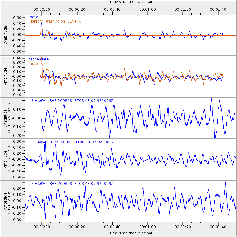
Signal To Noise
| Channel | StoN | STA | LTA |
| US:HAWA: :BHN:20080813T08:43:07.925009Z | 3.9559932 | 2.4656714E-7 | 6.2327494E-8 |
| US:HAWA: :BHE:20080813T08:43:07.925009Z | 1.4851528 | 9.034357E-8 | 6.0831155E-8 |
| US:HAWA: :BHZ:20080813T08:43:07.925009Z | 1.0224036 | 7.13285E-8 | 6.9765505E-8 |
| Arrivals |
| Ps | |
| PpPs | |
| PsPs/PpSs | |


