You are here: Home > Network List > US - United States National Seismic Network Stations List
> Station HAWA Hanford, Washington, USA > Earthquake Result Viewer
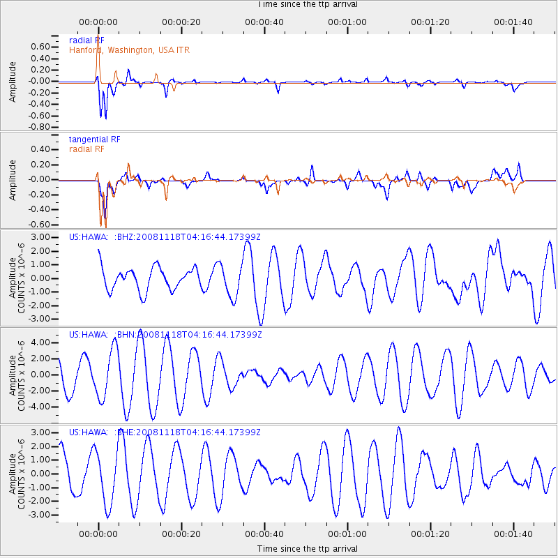
HAWA Hanford, Washington, USA - Earthquake Result Viewer
*The percent match for this event was below the threshold and hence no stack was calculated.
| Earthquake location: |
Arctic Ocean |
| Earthquake latitude/longitude: |
79.8/-115.9 |
| Earthquake time(UTC): |
2008/11/18 (323) 04:10:35 GMT |
| Earthquake Depth: |
10 km |
| Earthquake Magnitude: |
5.5 ML, 5.2 MB |
| Earthquake Catalog/Contributor: |
WHDF/NEIC |
|
| Network: |
US United States National Seismic Network |
| Station: |
HAWA Hanford, Washington, USA |
| Lat/Lon: |
46.39 N/119.53 W |
| Elevation: |
364 m |
|
| Distance: |
33.5 deg |
| Az: |
184.591 deg |
| Baz: |
1.185 deg |
| Ray Param: |
$rayparam |
*The percent match for this event was below the threshold and hence was not used in the summary stack. |
|
| Radial Match: |
81.83995 % |
| Radial Bump: |
394 |
| Transverse Match: |
60.679485 % |
| Transverse Bump: |
400 |
| SOD ConfigId: |
2658 |
| Insert Time: |
2010-03-05 05:15:25.740 +0000 |
| GWidth: |
2.5 |
| Max Bumps: |
400 |
| Tol: |
0.001 |
|
Signal To Noise
| Channel | StoN | STA | LTA |
| US:HAWA: :BHN:20081118T04:16:44.17399Z | 1.737452 | 3.1021223E-6 | 1.7854434E-6 |
| US:HAWA: :BHE:20081118T04:16:44.17399Z | 1.1723957 | 1.953379E-6 | 1.6661431E-6 |
| US:HAWA: :BHZ:20081118T04:16:44.17399Z | 1.4644938 | 1.1976502E-6 | 8.177913E-7 |
| Arrivals |
| Ps | |
| PpPs | |
| PsPs/PpSs | |


