You are here: Home > Network List > US - United States National Seismic Network Stations List
> Station HAWA Hanford, Washington, USA > Earthquake Result Viewer
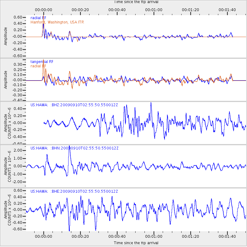
HAWA Hanford, Washington, USA - Earthquake Result Viewer
*The percent match for this event was below the threshold and hence no stack was calculated.
| Earthquake location: |
Kuril Islands |
| Earthquake latitude/longitude: |
48.3/154.2 |
| Earthquake time(UTC): |
2009/09/10 (253) 02:46:50 GMT |
| Earthquake Depth: |
36 km |
| Earthquake Magnitude: |
6.0 MB, 5.5 MS, 6.0 MW, 5.8 MW |
| Earthquake Catalog/Contributor: |
WHDF/NEIC |
|
| Network: |
US United States National Seismic Network |
| Station: |
HAWA Hanford, Washington, USA |
| Lat/Lon: |
46.39 N/119.53 W |
| Elevation: |
364 m |
|
| Distance: |
55.4 deg |
| Az: |
57.014 deg |
| Baz: |
306.008 deg |
| Ray Param: |
$rayparam |
*The percent match for this event was below the threshold and hence was not used in the summary stack. |
|
| Radial Match: |
79.311516 % |
| Radial Bump: |
400 |
| Transverse Match: |
73.34265 % |
| Transverse Bump: |
400 |
| SOD ConfigId: |
2622 |
| Insert Time: |
2010-03-05 05:15:29.410 +0000 |
| GWidth: |
2.5 |
| Max Bumps: |
400 |
| Tol: |
0.001 |
|
Signal To Noise
| Channel | StoN | STA | LTA |
| US:HAWA: :BHN:20090910T02:55:50.550012Z | 3.7658608 | 6.216362E-7 | 1.6507148E-7 |
| US:HAWA: :BHE:20090910T02:55:50.550012Z | 1.9220924 | 1.359127E-7 | 7.07108E-8 |
| US:HAWA: :BHZ:20090910T02:55:50.550012Z | 2.203763 | 1.7119729E-7 | 7.768408E-8 |
| Arrivals |
| Ps | |
| PpPs | |
| PsPs/PpSs | |


