You are here: Home > Network List > US - United States National Seismic Network Stations List
> Station HAWA Hanford, Washington, USA > Earthquake Result Viewer
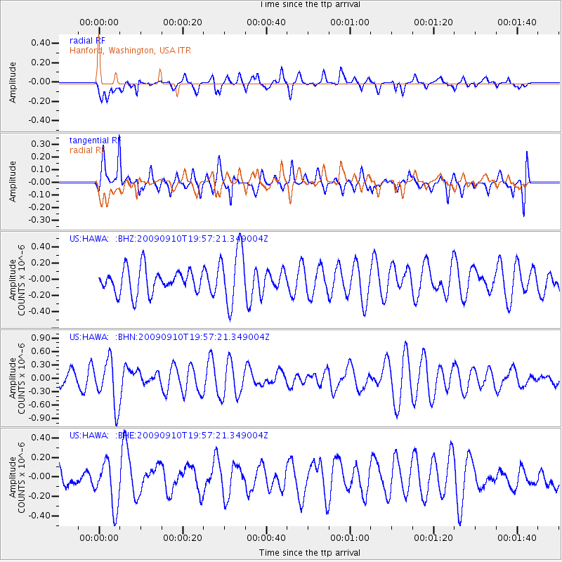
HAWA Hanford, Washington, USA - Earthquake Result Viewer
*The percent match for this event was below the threshold and hence no stack was calculated.
| Earthquake location: |
Easter Island Region |
| Earthquake latitude/longitude: |
-29.9/-111.8 |
| Earthquake time(UTC): |
2009/09/10 (253) 19:46:03 GMT |
| Earthquake Depth: |
10 km |
| Earthquake Magnitude: |
5.5 MW, 5.4 MB |
| Earthquake Catalog/Contributor: |
WHDF/NEIC |
|
| Network: |
US United States National Seismic Network |
| Station: |
HAWA Hanford, Washington, USA |
| Lat/Lon: |
46.39 N/119.53 W |
| Elevation: |
364 m |
|
| Distance: |
76.3 deg |
| Az: |
354.516 deg |
| Baz: |
173.116 deg |
| Ray Param: |
$rayparam |
*The percent match for this event was below the threshold and hence was not used in the summary stack. |
|
| Radial Match: |
38.952614 % |
| Radial Bump: |
400 |
| Transverse Match: |
64.04282 % |
| Transverse Bump: |
400 |
| SOD ConfigId: |
2622 |
| Insert Time: |
2010-03-05 05:15:30.403 +0000 |
| GWidth: |
2.5 |
| Max Bumps: |
400 |
| Tol: |
0.001 |
|
Signal To Noise
| Channel | StoN | STA | LTA |
| US:HAWA: :BHN:20090910T19:57:21.349004Z | 2.7008994 | 5.2661045E-7 | 1.9497595E-7 |
| US:HAWA: :BHE:20090910T19:57:21.349004Z | 2.3063927 | 2.4144242E-7 | 1.0468401E-7 |
| US:HAWA: :BHZ:20090910T19:57:21.349004Z | 2.433105 | 3.583671E-7 | 1.4728796E-7 |
| Arrivals |
| Ps | |
| PpPs | |
| PsPs/PpSs | |


