You are here: Home > Network List > US - United States National Seismic Network Stations List
> Station HAWA Hanford, Washington, USA > Earthquake Result Viewer
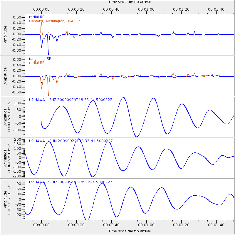
HAWA Hanford, Washington, USA - Earthquake Result Viewer
*The percent match for this event was below the threshold and hence no stack was calculated.
| Earthquake location: |
Tonga Islands |
| Earthquake latitude/longitude: |
-16.1/-173.3 |
| Earthquake time(UTC): |
2009/09/29 (272) 18:22:13 GMT |
| Earthquake Depth: |
10 km |
| Earthquake Magnitude: |
5.7 MB |
| Earthquake Catalog/Contributor: |
WHDF/NEIC |
|
| Network: |
US United States National Seismic Network |
| Station: |
HAWA Hanford, Washington, USA |
| Lat/Lon: |
46.39 N/119.53 W |
| Elevation: |
364 m |
|
| Distance: |
78.8 deg |
| Az: |
34.672 deg |
| Baz: |
232.184 deg |
| Ray Param: |
$rayparam |
*The percent match for this event was below the threshold and hence was not used in the summary stack. |
|
| Radial Match: |
97.60928 % |
| Radial Bump: |
248 |
| Transverse Match: |
71.63222 % |
| Transverse Bump: |
400 |
| SOD ConfigId: |
2622 |
| Insert Time: |
2010-03-05 05:15:34.510 +0000 |
| GWidth: |
2.5 |
| Max Bumps: |
400 |
| Tol: |
0.001 |
|
Signal To Noise
| Channel | StoN | STA | LTA |
| US:HAWA: :BHN:20090929T18:33:44.500022Z | 1.0056531 | 1.2140604E-4 | 1.2072357E-4 |
| US:HAWA: :BHE:20090929T18:33:44.500022Z | 1.8221872 | 9.218947E-5 | 5.0592756E-5 |
| US:HAWA: :BHZ:20090929T18:33:44.500022Z | 1.4238964 | 9.4506155E-5 | 6.637151E-5 |
| Arrivals |
| Ps | |
| PpPs | |
| PsPs/PpSs | |


