You are here: Home > Network List > US - United States National Seismic Network Stations List
> Station HAWA Hanford, Washington, USA > Earthquake Result Viewer
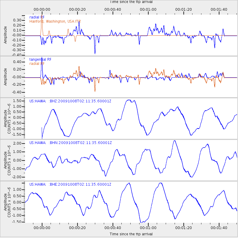
HAWA Hanford, Washington, USA - Earthquake Result Viewer
*The percent match for this event was below the threshold and hence no stack was calculated.
| Earthquake location: |
Santa Cruz Islands |
| Earthquake latitude/longitude: |
-11.9/166.0 |
| Earthquake time(UTC): |
2009/10/08 (281) 01:59:19 GMT |
| Earthquake Depth: |
35 km |
| Earthquake Magnitude: |
5.9 MB |
| Earthquake Catalog/Contributor: |
WHDF/NEIC |
|
| Network: |
US United States National Seismic Network |
| Station: |
HAWA Hanford, Washington, USA |
| Lat/Lon: |
46.39 N/119.53 W |
| Elevation: |
364 m |
|
| Distance: |
88.1 deg |
| Az: |
41.863 deg |
| Baz: |
250.691 deg |
| Ray Param: |
$rayparam |
*The percent match for this event was below the threshold and hence was not used in the summary stack. |
|
| Radial Match: |
78.47114 % |
| Radial Bump: |
357 |
| Transverse Match: |
52.84819 % |
| Transverse Bump: |
306 |
| SOD ConfigId: |
2622 |
| Insert Time: |
2010-03-05 05:15:40.296 +0000 |
| GWidth: |
2.5 |
| Max Bumps: |
400 |
| Tol: |
0.001 |
|
Signal To Noise
| Channel | StoN | STA | LTA |
| US:HAWA: :BHN:20091008T02:11:35.60001Z | 0.89662904 | 7.249048E-7 | 8.084779E-7 |
| US:HAWA: :BHE:20091008T02:11:35.60001Z | 0.9749235 | 4.1199434E-7 | 4.2259146E-7 |
| US:HAWA: :BHZ:20091008T02:11:35.60001Z | 1.3400111 | 1.0361741E-6 | 7.7325785E-7 |
| Arrivals |
| Ps | |
| PpPs | |
| PsPs/PpSs | |


