You are here: Home > Network List > US - United States National Seismic Network Stations List
> Station HAWA Hanford, Washington, USA > Earthquake Result Viewer
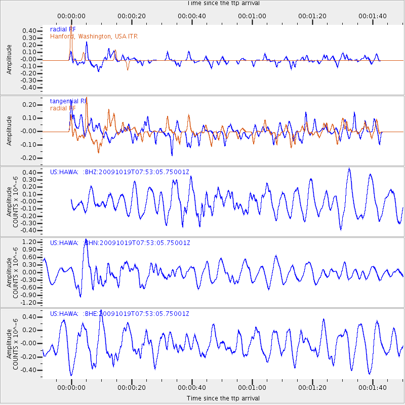
HAWA Hanford, Washington, USA - Earthquake Result Viewer
*The percent match for this event was below the threshold and hence no stack was calculated.
| Earthquake location: |
Samoa Islands Region |
| Earthquake latitude/longitude: |
-15.4/-173.0 |
| Earthquake time(UTC): |
2009/10/19 (292) 07:41:38 GMT |
| Earthquake Depth: |
10 km |
| Earthquake Magnitude: |
5.8 MW, 5.4 MS, 5.4 MB, 5.8 MW |
| Earthquake Catalog/Contributor: |
WHDF/NEIC |
|
| Network: |
US United States National Seismic Network |
| Station: |
HAWA Hanford, Washington, USA |
| Lat/Lon: |
46.39 N/119.53 W |
| Elevation: |
364 m |
|
| Distance: |
78.1 deg |
| Az: |
34.627 deg |
| Baz: |
232.349 deg |
| Ray Param: |
$rayparam |
*The percent match for this event was below the threshold and hence was not used in the summary stack. |
|
| Radial Match: |
67.96389 % |
| Radial Bump: |
382 |
| Transverse Match: |
56.760166 % |
| Transverse Bump: |
400 |
| SOD ConfigId: |
2622 |
| Insert Time: |
2010-03-05 05:15:42.309 +0000 |
| GWidth: |
2.5 |
| Max Bumps: |
400 |
| Tol: |
0.001 |
|
Signal To Noise
| Channel | StoN | STA | LTA |
| US:HAWA: :BHN:20091019T07:53:05.75001Z | 2.4521255 | 6.223687E-7 | 2.5380785E-7 |
| US:HAWA: :BHE:20091019T07:53:05.75001Z | 1.1775602 | 2.7341787E-7 | 2.3219013E-7 |
| US:HAWA: :BHZ:20091019T07:53:05.75001Z | 1.7737802 | 1.9758718E-7 | 1.1139327E-7 |
| Arrivals |
| Ps | |
| PpPs | |
| PsPs/PpSs | |


