You are here: Home > Network List > US - United States National Seismic Network Stations List
> Station HAWA Hanford, Washington, USA > Earthquake Result Viewer
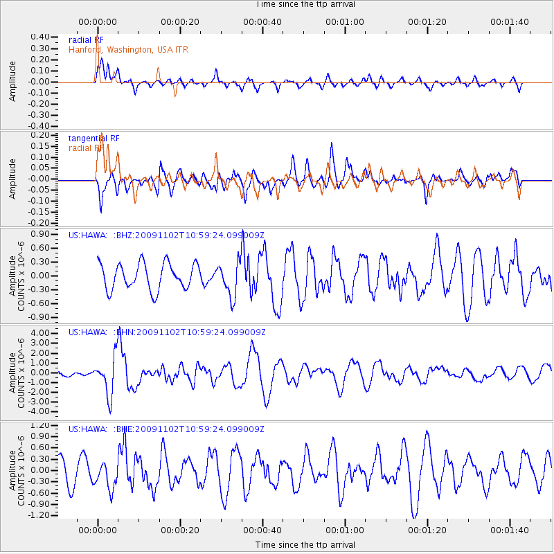
HAWA Hanford, Washington, USA - Earthquake Result Viewer
*The percent match for this event was below the threshold and hence no stack was calculated.
| Earthquake location: |
South Of Tonga Islands |
| Earthquake latitude/longitude: |
-24.1/-175.2 |
| Earthquake time(UTC): |
2009/11/02 (306) 10:47:13 GMT |
| Earthquake Depth: |
9.0 km |
| Earthquake Magnitude: |
6.1 MB, 6.1 MS, 6.2 MW, 6.1 MW |
| Earthquake Catalog/Contributor: |
WHDF/NEIC |
|
| Network: |
US United States National Seismic Network |
| Station: |
HAWA Hanford, Washington, USA |
| Lat/Lon: |
46.39 N/119.53 W |
| Elevation: |
364 m |
|
| Distance: |
86.4 deg |
| Az: |
34.927 deg |
| Baz: |
229.096 deg |
| Ray Param: |
$rayparam |
*The percent match for this event was below the threshold and hence was not used in the summary stack. |
|
| Radial Match: |
47.50985 % |
| Radial Bump: |
400 |
| Transverse Match: |
63.344 % |
| Transverse Bump: |
400 |
| SOD ConfigId: |
2622 |
| Insert Time: |
2010-03-05 05:15:46.519 +0000 |
| GWidth: |
2.5 |
| Max Bumps: |
400 |
| Tol: |
0.001 |
|
Signal To Noise
| Channel | StoN | STA | LTA |
| US:HAWA: :BHN:20091102T10:59:24.099009Z | 7.4751835 | 1.9985678E-6 | 2.6736038E-7 |
| US:HAWA: :BHE:20091102T10:59:24.099009Z | 1.2954682 | 3.4943352E-7 | 2.6973532E-7 |
| US:HAWA: :BHZ:20091102T10:59:24.099009Z | 1.3556696 | 3.799759E-7 | 2.8028649E-7 |
| Arrivals |
| Ps | |
| PpPs | |
| PsPs/PpSs | |


