You are here: Home > Network List > US - United States National Seismic Network Stations List
> Station HAWA Hanford, Washington, USA > Earthquake Result Viewer
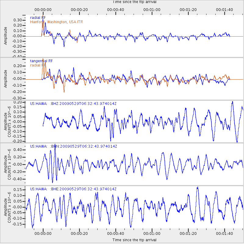
HAWA Hanford, Washington, USA - Earthquake Result Viewer
*The percent match for this event was below the threshold and hence no stack was calculated.
| Earthquake location: |
Vanuatu Islands |
| Earthquake latitude/longitude: |
-17.0/168.3 |
| Earthquake time(UTC): |
2009/05/29 (149) 06:20:14 GMT |
| Earthquake Depth: |
13 km |
| Earthquake Magnitude: |
5.5 MB, 5.5 MS, 5.7 MW, 5.6 MW |
| Earthquake Catalog/Contributor: |
WHDF/NEIC |
|
| Network: |
US United States National Seismic Network |
| Station: |
HAWA Hanford, Washington, USA |
| Lat/Lon: |
46.39 N/119.53 W |
| Elevation: |
364 m |
|
| Distance: |
90.4 deg |
| Az: |
41.208 deg |
| Baz: |
245.592 deg |
| Ray Param: |
$rayparam |
*The percent match for this event was below the threshold and hence was not used in the summary stack. |
|
| Radial Match: |
53.285732 % |
| Radial Bump: |
400 |
| Transverse Match: |
63.03383 % |
| Transverse Bump: |
400 |
| SOD ConfigId: |
2648 |
| Insert Time: |
2010-03-05 05:15:49.177 +0000 |
| GWidth: |
2.5 |
| Max Bumps: |
400 |
| Tol: |
0.001 |
|
Signal To Noise
| Channel | StoN | STA | LTA |
| US:HAWA: :BHN:20090529T06:32:43.974014Z | 2.6724544 | 2.1672003E-7 | 8.1094E-8 |
| US:HAWA: :BHE:20090529T06:32:43.974014Z | 1.2019049 | 5.4458155E-8 | 4.530987E-8 |
| US:HAWA: :BHZ:20090529T06:32:43.974014Z | 1.6367328 | 7.43895E-8 | 4.5449998E-8 |
| Arrivals |
| Ps | |
| PpPs | |
| PsPs/PpSs | |


