You are here: Home > Network List > US - United States National Seismic Network Stations List
> Station HAWA Hanford, Washington, USA > Earthquake Result Viewer
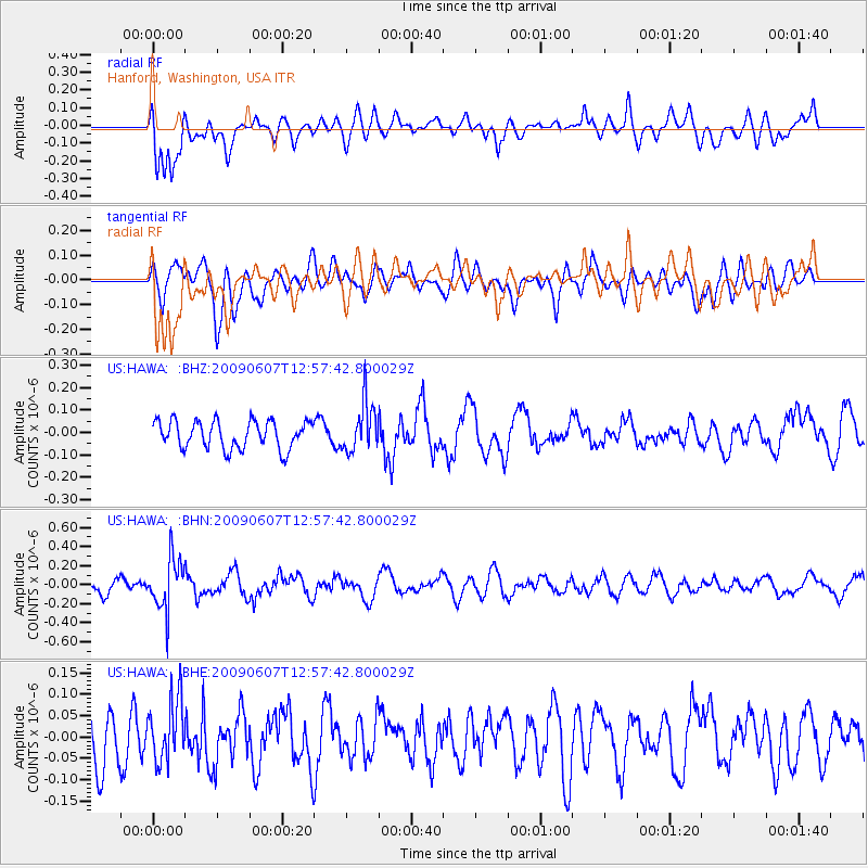
HAWA Hanford, Washington, USA - Earthquake Result Viewer
*The percent match for this event was below the threshold and hence no stack was calculated.
| Earthquake location: |
South Of Fiji Islands |
| Earthquake latitude/longitude: |
-22.0/-179.6 |
| Earthquake time(UTC): |
2009/06/07 (158) 12:46:30 GMT |
| Earthquake Depth: |
590 km |
| Earthquake Magnitude: |
5.5 MW, 5.1 MB |
| Earthquake Catalog/Contributor: |
WHDF/NEIC |
|
| Network: |
US United States National Seismic Network |
| Station: |
HAWA Hanford, Washington, USA |
| Lat/Lon: |
46.39 N/119.53 W |
| Elevation: |
364 m |
|
| Distance: |
87.1 deg |
| Az: |
36.906 deg |
| Baz: |
233.608 deg |
| Ray Param: |
$rayparam |
*The percent match for this event was below the threshold and hence was not used in the summary stack. |
|
| Radial Match: |
65.127426 % |
| Radial Bump: |
400 |
| Transverse Match: |
56.85842 % |
| Transverse Bump: |
400 |
| SOD ConfigId: |
2648 |
| Insert Time: |
2010-03-05 05:15:56.126 +0000 |
| GWidth: |
2.5 |
| Max Bumps: |
400 |
| Tol: |
0.001 |
|
Signal To Noise
| Channel | StoN | STA | LTA |
| US:HAWA: :BHN:20090607T12:57:42.800029Z | 4.0650334 | 2.694411E-7 | 6.6282624E-8 |
| US:HAWA: :BHE:20090607T12:57:42.800029Z | 1.1462029 | 7.188623E-8 | 6.271684E-8 |
| US:HAWA: :BHZ:20090607T12:57:42.800029Z | 1.7422159 | 1.0753209E-7 | 6.172145E-8 |
| Arrivals |
| Ps | |
| PpPs | |
| PsPs/PpSs | |


