You are here: Home > Network List > US - United States National Seismic Network Stations List
> Station HAWA Hanford, Washington, USA > Earthquake Result Viewer
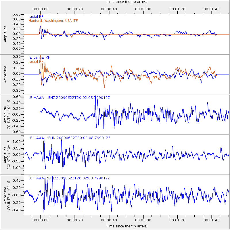
HAWA Hanford, Washington, USA - Earthquake Result Viewer
*The percent match for this event was below the threshold and hence no stack was calculated.
| Earthquake location: |
Andreanof Islands, Aleutian Is. |
| Earthquake latitude/longitude: |
51.3/-178.2 |
| Earthquake time(UTC): |
2009/06/22 (173) 19:55:24 GMT |
| Earthquake Depth: |
35 km |
| Earthquake Magnitude: |
5.6 MB, 5.6 MW, 5.6 MW |
| Earthquake Catalog/Contributor: |
WHDF/NEIC |
|
| Network: |
US United States National Seismic Network |
| Station: |
HAWA Hanford, Washington, USA |
| Lat/Lon: |
46.39 N/119.53 W |
| Elevation: |
364 m |
|
| Distance: |
38.0 deg |
| Az: |
73.663 deg |
| Baz: |
299.442 deg |
| Ray Param: |
$rayparam |
*The percent match for this event was below the threshold and hence was not used in the summary stack. |
|
| Radial Match: |
57.264202 % |
| Radial Bump: |
400 |
| Transverse Match: |
63.329258 % |
| Transverse Bump: |
400 |
| SOD ConfigId: |
2648 |
| Insert Time: |
2010-03-05 05:16:02.897 +0000 |
| GWidth: |
2.5 |
| Max Bumps: |
400 |
| Tol: |
0.001 |
|
Signal To Noise
| Channel | StoN | STA | LTA |
| US:HAWA: :BHN:20090622T20:02:08.799012Z | 4.5025253 | 4.855554E-7 | 1.0784068E-7 |
| US:HAWA: :BHE:20090622T20:02:08.799012Z | 2.935816 | 2.1854794E-7 | 7.444197E-8 |
| US:HAWA: :BHZ:20090622T20:02:08.799012Z | 2.3595614 | 2.4368737E-7 | 1.0327656E-7 |
| Arrivals |
| Ps | |
| PpPs | |
| PsPs/PpSs | |


